Trek to Theu-la, Thomphyok valley and Zemu Glacier, North Sikkim 2016
Summary
Dream Wanderlust began its North Sikkim Exploration in 2016 with Green Lake Trek. We trekked through Mukuthang valley and successfully crossed Theu-la. Unfortunately, due to heavy snow deposition, we could not cross Thangchu la, the pass to get the Zemu Glacier directly. We had to take an unconventional route and interestingly, it became a blessing in disguise for us. After crossing Theu-la, we trekked around the ridge and spotted a beauteous valley there, named Thomhayak. We camped out in Thomhayak valley that day and documented the region. The next day, we walked across the valley, along the bank of Thomhayak chu, and later, we continued through the conventional route via Yabuk and reached the Zemu glacier region and Green Lake.
Background
Kangchenjunga is not just a mountain; she is a world within herself. The mountain community worships her as sacred. The fascinating beauty of Kangchenjunga always overwhelms our hearts and soul. We all grow up adoring her; her alluring beauty provokes us to set our foot out, again and again
Objective
In 2016, Dream Wanderlust started North Sikkim Exploration. We attempted different unconventional routes in this course. We gratified our wanderlust, exploring unexplored regions of North Sikkim and thoroughly, documenting those areas.
On the other hand, the longing to experience the grand appearance of the World’s most beautiful snow mountain, Mt. Siniolchu, and the largest Eastern Himalayan glacier, Zemu glacier was also a stimulating factor to embark on this odyssey.
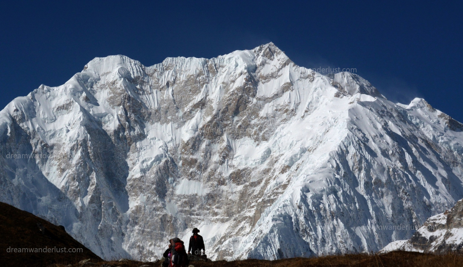
Kangchenjugha East Face from Zemu Glacier
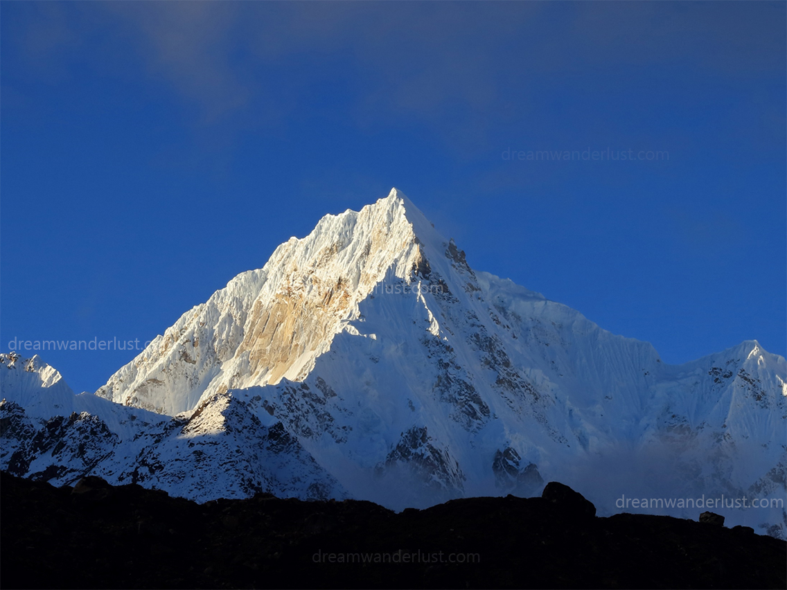
Sinolchu from the Rest Camp
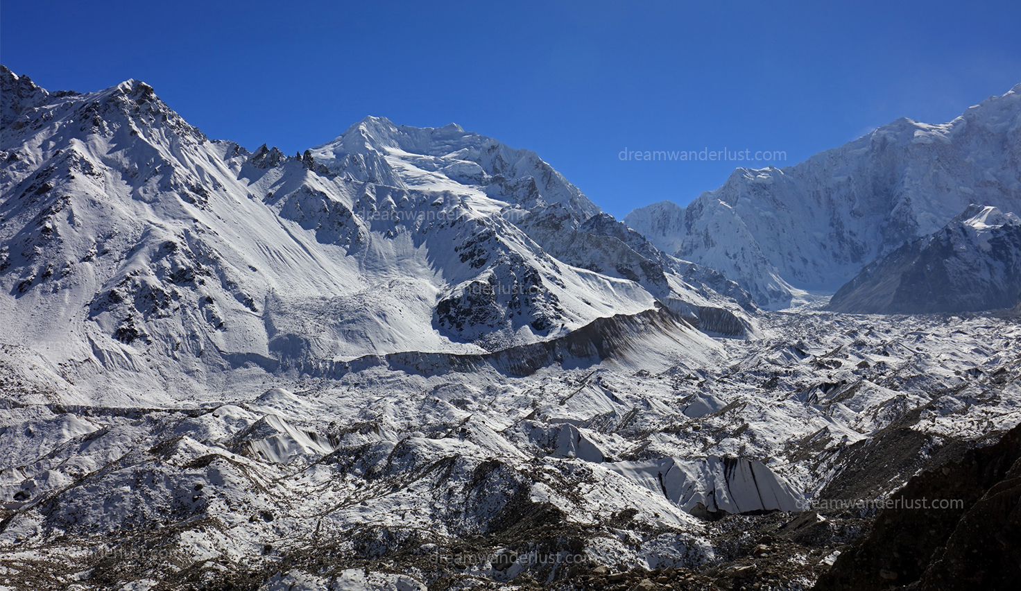
The Zemu Glacier
Day-to-day note
With hopes in heart and apprehension in mind, in October 2016, we started our journey from Kolkata by train and reached New Jalpaiguri the next day in the morning. We hired a car from New Jalpaiguri Railway Station and it drove us to Mangan in HRS. We passed that day in leisure and enjoyed the lovely mountainous ambiance in Mangan.
Day 1 (Mangan to Kalapatthar)
Next day, early in the morning, we started for Kalapatthar by car. Our guide and his team joined us in Lachen and we collected ration from Thangu and Chopta. The car dropped us near Kalapatthar and we walked 30 minutes approx. to reach our campsite that day.
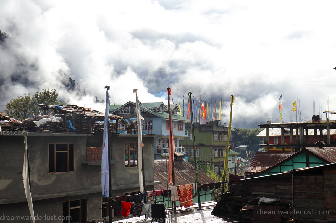
Lachen
Chopta Valley
Day 2 (Kalapatthar to Mukuthang /6h)
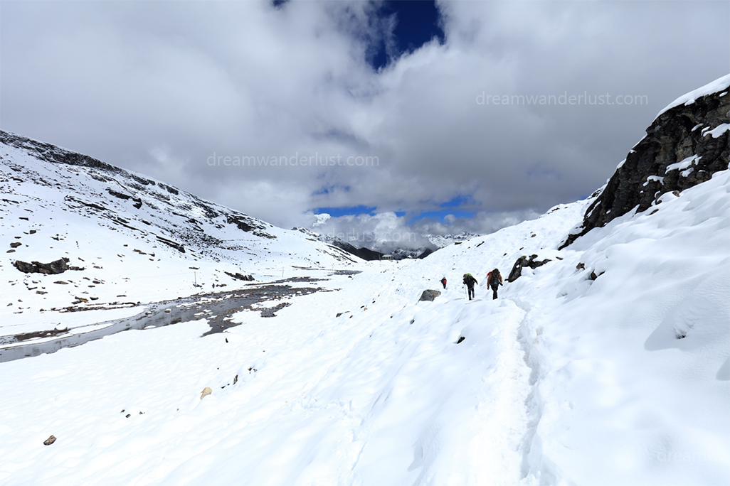
The morning view at the Kalapatthar campsite was bright and refreshing. We packed our belongings and hit the road, early in the morning. We were ascending towards Lungnak la (5035m), keeping Kanchengyo (6889m) at the background, and kept on walking through a fully snow-covered trail. When we reached Lungnak la, we were all exhausted and relieved at the same time, little did we know what was waiting for us afterward! Next, we had to descend a steep path. It was already afternoon and a platoon of soldiers passed the trail just before us. So, naturally, the snow had already started taking ice formation, making it much more arduous for us. We all slipped several times. Later, on our way to Mukuthang, we earned a spectacular view of a lake and it was worth the pain. The wonderful landscape with Pyramid (7123m), Langpo (6954m), and Domekang (7260m) over the horizon left us amazed. The Sun came out of the veil of clouds and energized our weary selves. We spent some time there. Unfortunately, we didn’t have much idea how long it might take to reach Mukuthang. When we reached Mukuthang, totally worn out, negotiating our way in the moonlight, it was about 8 pm.
Kalapathhar Campsite
Approaching Lungnak La
Below Lungnak La
View towards Mukuthang
Day 3 (Rest Day at Mukuthang)
We spent a day in Mukuthang for acclimatization. The vista of Kanchenjunga and Yalung Kang from Mukuthang valley was ineffable. While the distant view of Naku la (5270m) and Theu la (5212m) was enticing, the majestic Pyramid(*m) stirred up humility in us. The amazing Thangchung Kang(*m) was also visible from Mukuthang valley. We spent our afternoon at the bank of calm Naku chu. We had a great time with the Indian Army, in Mukuthang. They were very cordial with us and offered us food and juice.
Day 4 (Mukuthang to Langpo/4h)
We started walking in the direction of Dolmasampa; en route, the scenic beauty of Pyramid and Kanchenjunga from Teblhe made our journey more delightful. Dolmasampa was a vast plateau. We kept on moving towards Dolmasampa bridge, unhurriedly, enjoying the pleasant nature. We came across Lhonak chu and Kora chu there. A glimpse of Langpo (6954m) and Jongsong (*m) caught our attention while we were heading toward Langpo. We passed across a field and set up our camp in the stunning backdrop of the Kora Kang range.
Day 5 (Langpo to Theu La base/4hrs)
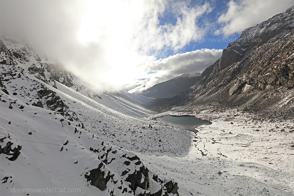
TIn the morning, we explored our campsite, which was a yak herding ground, and photographed some exquisite macro elements. The beauty of Kora Kang (6047m) and Chobuk la (5510m) over the horizon was captivating. When we started ascending, we got a vivid view of Kora la amid Kora Kang Range. As we kept on ascending, Mt. Langpo and Mt. Domekang appeared before us. The view of Chobuk la was undoubtedly tempting. We promised ourselves that we would definitely explore those areas in the next expeditions and headed towards Theu la. En route, we caught a panoramic view of Kora chu valley and Mukuthang valley. We took a short break beside a beautiful lake for some time and after that, we walked through the snow-filled trail to reach our campsite, just below Theu la (5212m). We enjoyed that freezing evening with delicious snacks and hot coffee.
Day 6 (Theu La base to Thomahyak valley /10hrs)
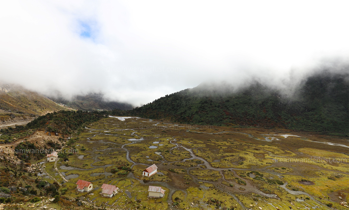
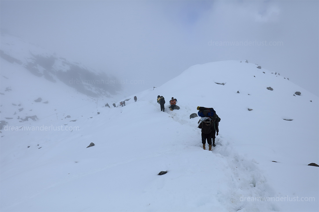
It was a vast, fully snow-covered area before us when we began our journey towards Theu la. We kept on approaching through stones to avoid snow as much as possible. After ascending Theu la, we offered prayers in a temple and relaxed for a bit. The frame on the opposite side was completely white, overlaid with snow and clouds. We entered into the frame, in the direction of Theu Lacha. We stole a glance at Thangchu la there, through the veils of clouds. We had to cross Thangchu la to reach Zemu Rest Camp but we called it off due to heavy snow deposition. Leaving our dream behind, we decided to trek around the ridge to avoid that avalanche-prone trail. We got a view of Thee on the way. After walking for some more time, we entered a trackless, untraversed area, Thomahyak Valley, and decided to spend that night there.
Day 7 (Thomahyak valley to above Yakthang Camp/10 hrs)
Thomahyak valley was divinely pleasant. The impressive valley was full of high-altitude plants. The medicinal plant Keerajuri is found there. Every nook and cranny of the valley was magnetic, whether it’s multi layered square shaped green grass or lovely colorful Rhododendrons, the beauty of this valley was striking. After having a sumptuous breakfast, we started descending in the morning. It was a shiny bright morning. We had to make our way through plants as there was no specific path but the trail was an easy one. Our team didn’t miss any chance to capture lovely macro elements of Thomahyak in the frame. We crossed the valley, walking along with the downstream of Thomahyak chu towards glorious Lamo Angdang (5868m). In front of Lamo Angdang, we took a diversion to the right from the point where Thomhyak chu and Zemu chu meet and continued our journey through the conventional route towards the Zemu glacier region. The route was mostly through dense forest areas but near Yakthang it was an easy village trail. After crossing Yakthang, we decided to call it a day and threw ourselves into arranging a campsite.
Day 8 (Yakthang to Yabuk/4hrs)
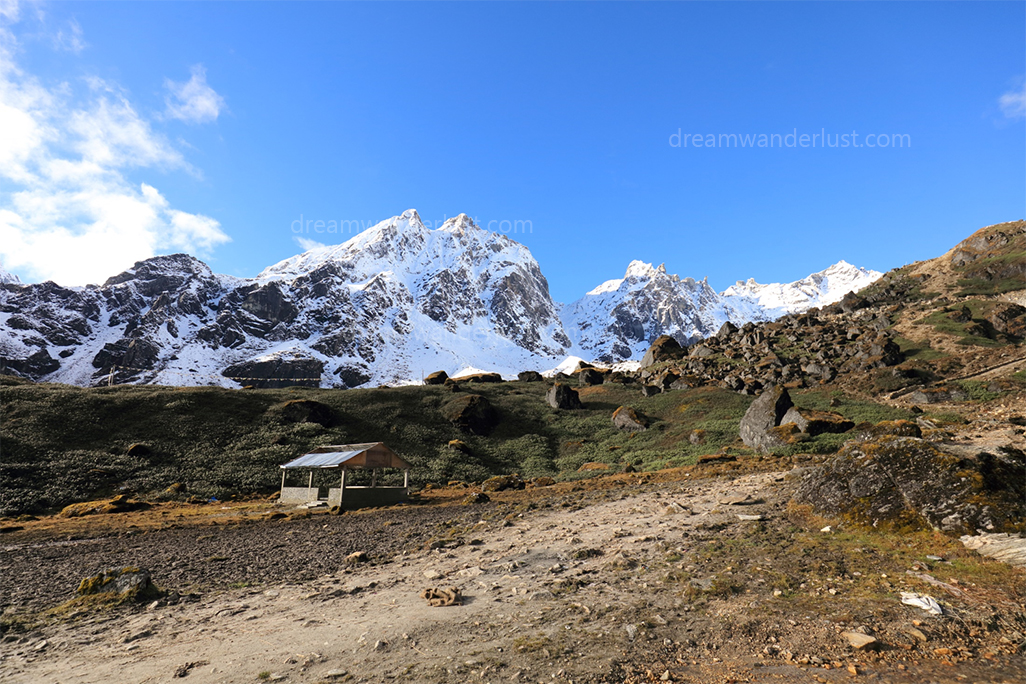
We moved towards the Zemu glacier along the upstream of Zemu chu. The greenery of the terrain was quite eye-soothing. The chirping of rock pigeons filled our hearts with joy. It was truly a blissful experience for all of us. We kept on ascending in the direction of Yabuk. We were all well acclimatized and at ease. At Yabuk (3978m), we found a hut, built by the Sikkim Forest Department. We took shelter in the hut and pitched a tent inside.
Day 9 (Yabuk to Rest Camp/4hrs)
Keeping Lamo Angdang in the background, we skillfully negotiated our way through scree zones and moraine areas. Shortly after that, the proper trial was found, made by the administration there. On the way, we saw the snout of Zemu glacier. By the side of the heaps of debris, along the river bank, we kept on moving towards Rest Camp. The view of mighty Kangchenjunga and twins peak from our campsite, at Zemu river bank, was brilliant. We climbed on the heaps of debris and encountered a breath-taking view of Zemu glacier. The in-line picturesque sight of Kangchenjunga, Siniolchu, and Simvo was enthralling. We heard glaciers breaking, and the perils of climate change.
Day 10 (Rest Camp to Green Lake Camp/4hrs)
In the morning, we witnessed an unforgettable sunrise at Kangchenjunga and Siniolchu from our campsite. Experiencing the splendid and grandeur look of Kangchenjunga and Siniolchu during the sunrise was greatly worthwhile. We all got ready early in the morning and departed for our next destination. We captured Siniolchu and Kangchenjunga from different angles on our way to the Green Lake region. The sharp peak of Mt. Siniolchu is really a marvelous piece of art of nature. On the other hand, the gorgeous Nepal peak(*m) also stunned us with its beauty. We were awestruck by the bewitching sight of peaks, all day long. We also witnessed an avalanche at the east face of Kangchenjunga. The Green Lake region was an endless vast valley. We chose a suitable place and put up our camp there.
Day 11 (Green Lake Camp to Yakthang/8hrs)
We were lucky. We secured another chance to watch fabulous sunrise amid mountains. The ethereal beauty of Kangchenjunga, Nepal peak, and Twins peak with the first ray of the Sun is inexplicable. We managed to catch a sight of Jomolhari (Chomolhari) peak(7326m) of Bhutan also, from our Green Lake campsite. We were all content, what we explored and experienced during this trek was beyond expectation. Now, it was our time to return. We started descending and the trail was quite easy. We crossed 3-4 campsites at a stretch and stayed the night at Yakthang.
Day 12 (Yakthang to Zema/6hrs)
We traversed forests and valleys, enjoying. But the last hurdle was still due. There was a huge landslide owning to heavy rainfalls near Zema. The path was washed away. We had to make our way somehow along the Zemu river and we crossed the rock fall zone with caution. Our trek ended at Zema, where Zemu chu meets Teesta. When we reached Lachen, we were all smiles. This exploratory trek made us more confident and curious than ever.
Next day, we returned to New Jalpaiguri via Lachen by car and boarded a train only to come back soon for our next session of North Sikkim Exploration in Nako, Kora, and Lhonak region.
Team Members: Supratm Mukherjee, Avijit Sur, Purba Ganguly, Pritam Das Sharma, Rahul Chakraborty, Shamita Chakraborty, and Nilanjan Patra
Written end edited by Rituparna Chowdhury