'In Pursuit of Purity' - Markha Valley Winter Expedition 2021
Markha Valley Winter Expedition - A Brief Report
The Proposal - A Pursuit of Purity
At the closing quarter of Ladakh's Winter, during the last week of February and first week of March, 2021, a team of two alpinists (Aloke Kumar Das and Anindya Mukherjee) decided to venture deep into the Markha valley with an eye of interest on the lesser known (and rarely climbed) peaks of KY III (6280m) and KY IV (6130m), located due South and South-West of the more popular Kang Yatse I (6400m) and II (6200m). The team decided to climb KY II as part of their acclimatization and then proceed to the exploratory part of their adventure via the Kongka Nongpo La (5080m).
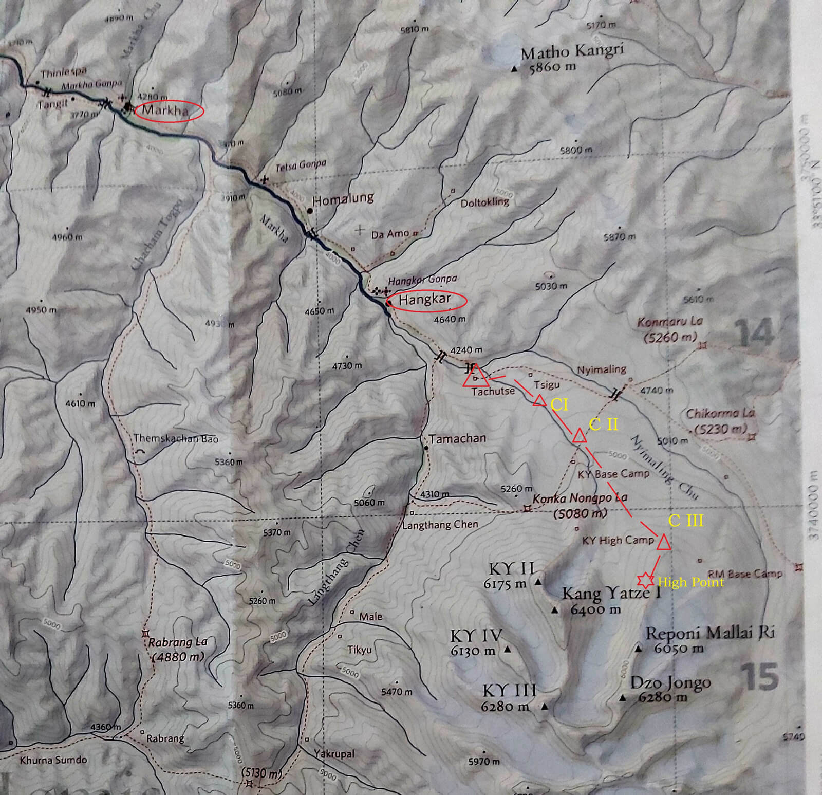
A map showing their route in Feb-March 2021. Red Circles are villages where they slept on their way in and out. Red Triangles are their camps. Tachutse as spelled on this map locally pronounced as 'Tachungtse'. Zangpo's mules brought them up to Tachungtse and it became their Base Camp in effect. The Red star shows their tentative high point of this trip. Actual coordinates of each camp and high point is provided in the report.
The Principles
The foundation of their adventure was based on the following principles:
- They would climb in him-alpine style - without involving multiple ferries, fixed camps or ropes.
- They would not hire any high-altitude support as porters and neither would they have any Base Camp support.
The Approach
Leh - Markha - Hangkar - Tachungtse (24th to 28th February)
On 24th February, the duo left Leh on a four-wheel drive car. A newly-built road (unsurfaced) brought them all the way to the village of Markha. Here, they met muleteer Zangpo (courtesy: Avilash Bisht). After spending another night (25th February) at Hangkar, and enjoying a scenic hike along the gorge of the completely frozen Markha river, Zangpo and his two mules brought the duo and their gear up to Tachungtse on the 26th February and bid them farewell. The climbers were finally left all on their own. With no another human being in sight, they felt the whole valley belonged to them, and them alone. Tachungtse became their obvious Base Camp. The duo spent the next two days (27-28 February) hiking the ridges due South of Nyimaling. This not only helped them acclimatize, but also gave them a fair idea of the terrain. It is during these last two days, they decided to bypass the meadows of Nyimaling altogether and adopt a more direct approach to the Kang Yatse massif from Tachungtse itself.
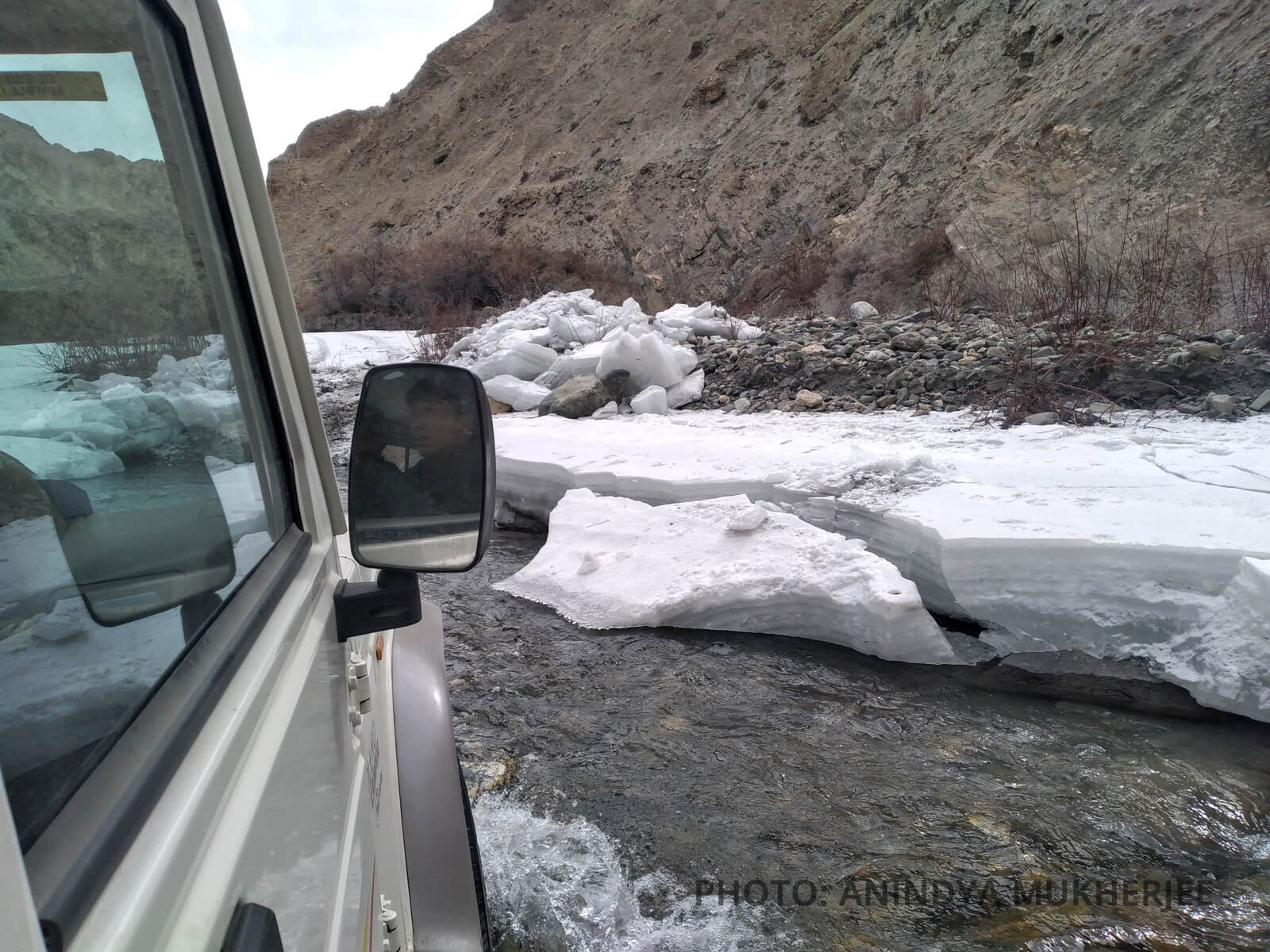
The road to Markha village. There were many river crossings en route.
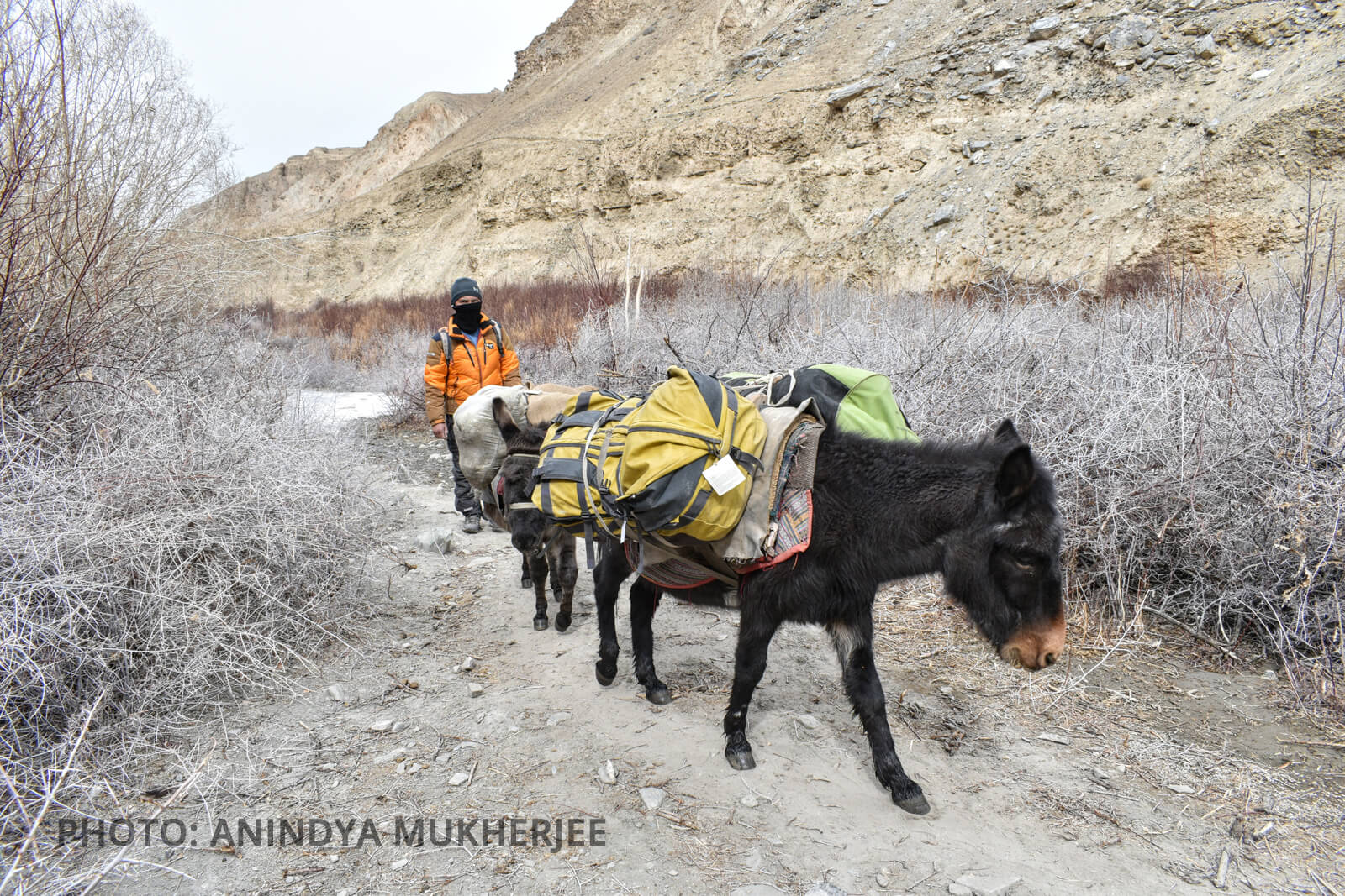
Zangpo drove two mules that brought their gear to Tachungtse
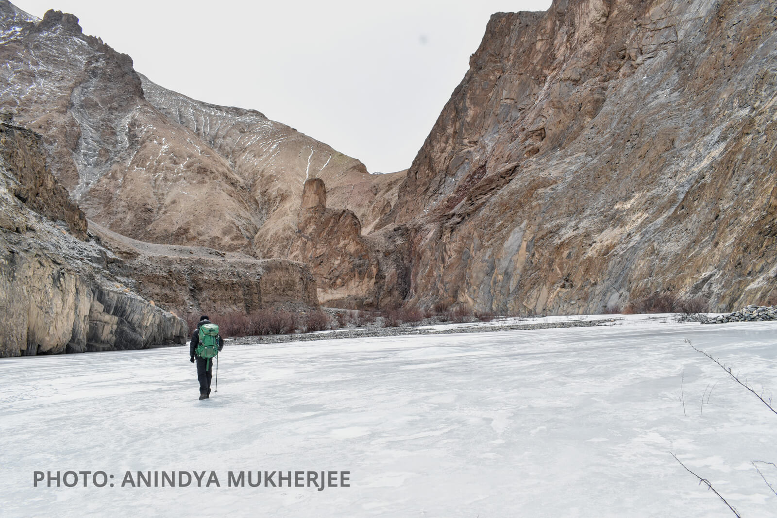
The highway of the river Markha
The Validation - 1st & 2nd March
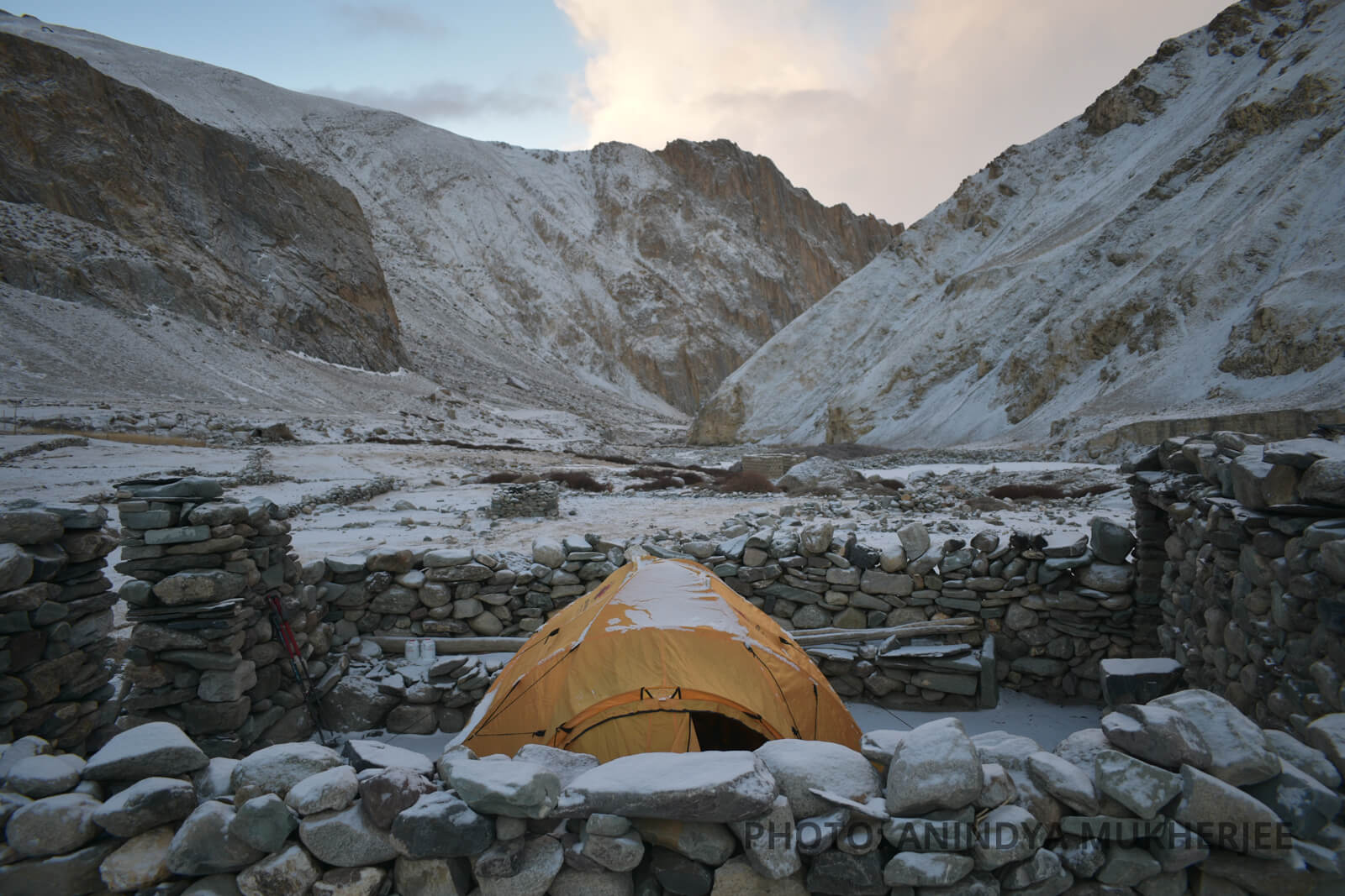
On 1st March, 2021, staying off the trail towards Nyimaling, the duo moved generally South-East of Tachungtse. Riding along a system of lateral moraine ridges, emanating from the KY massif, they camped next to the twin lakes, dedicated to the Guru Rimpoche. The altitude of the camp was approximately 4650m (Camp-1/Jheel camp, Coordinates-33°48'24.0''N, 77°33'34.0''E). On 2nd March, the duo made a direct approach towards KY-II with intentions of reaching its traditional high camp located on its NE spur. Within a couple of hours of leaving the Jheel camp, the duo had reached 4950m. The stable moraine ridge leading to the higher camp was within manageable distance. It was then the duo got struck by the first bolt from the blue. The duo could not believe their own eyes, as without a warning, the Vibram sole exfoliated off the left foot of Aloke's almost-new plastic boots (Asolo). It was a moment of disbelief, anger, frustration and reckoning at the same time. It was a blunt disposal of their purist proposal. Man proposes, boot disposes. Immediately, they duct-taped the boot only to realize and accept the fact that it would no longer be crampon-compatible and any decent level of snow and ice-climbing was out of the question in this particular trip. Then and there, the duo decided to call it a day and pitch tent. Thus point 4950m became their Camp-2 (Coordinates- 33°47'20.9''N, 77°33'39.9''E). Sitting in Camp-2, melting ice and sipping rounds of green tea, the duo decided to keep going. They knew climbing was not possible but they were aware of a few walkable peaks right across the glacier located due East of KY I. In fact, they were able to see the peaks Reponi Malai RI (6050m) and Dzo Jongo (6280m). A decision was reached. They would push further south-east the next day, traverse the glacier and establish another camp on the North Ridge of Reponi Malai Ri.
Jheel Camp/Camp-1, Kang Yatse massif shrouded in mist in the background
.jpg)
The Jheel Camp/Camp-1. Prayer flags fluttering towrads the Guru Rimpoche statue embedded in the left centre of photo. Kang Yatse I in shade while KY II shining its icy face.
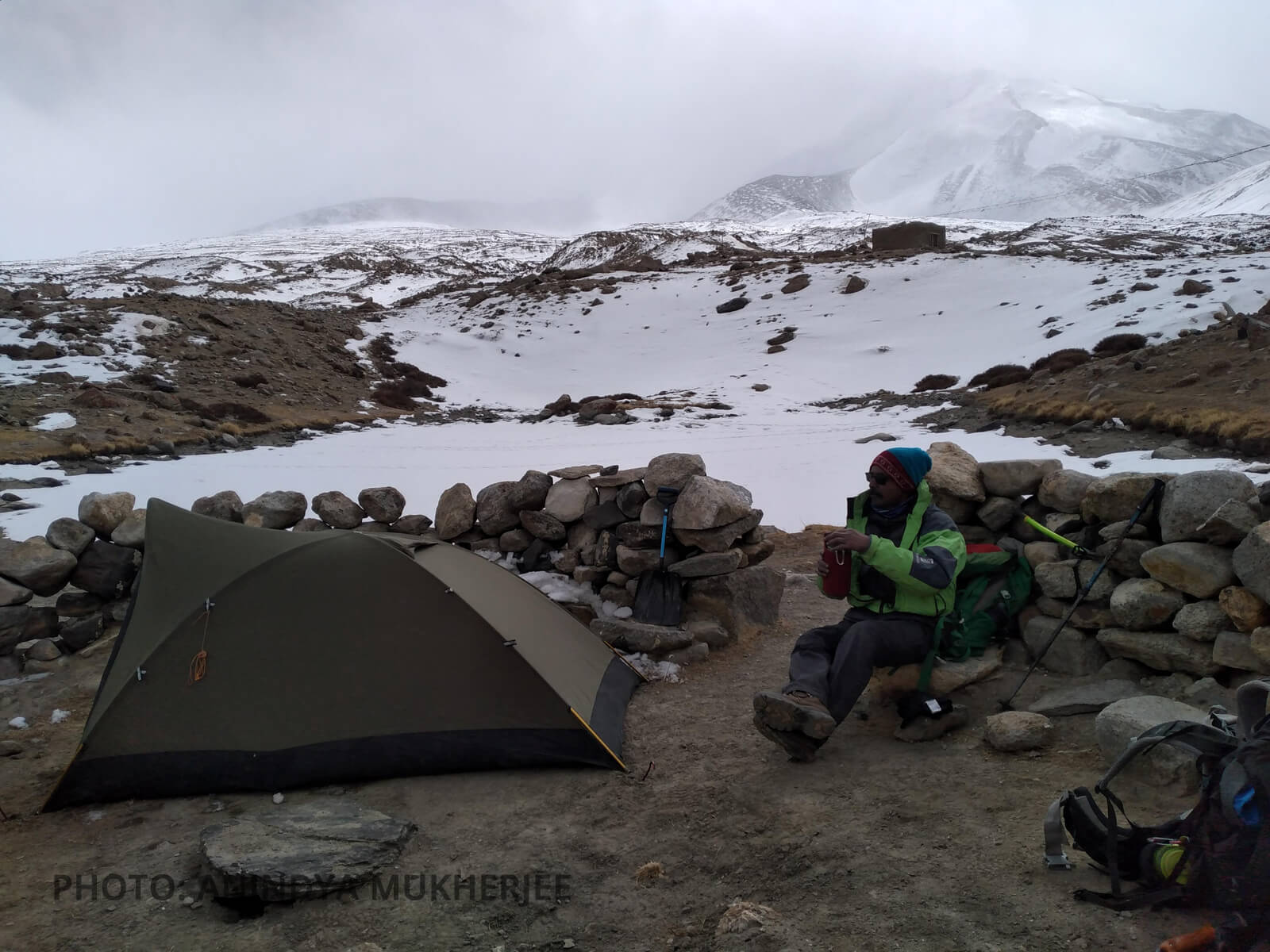
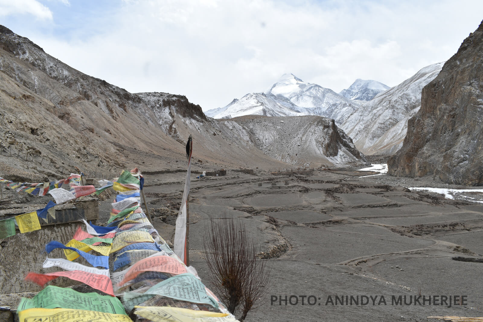
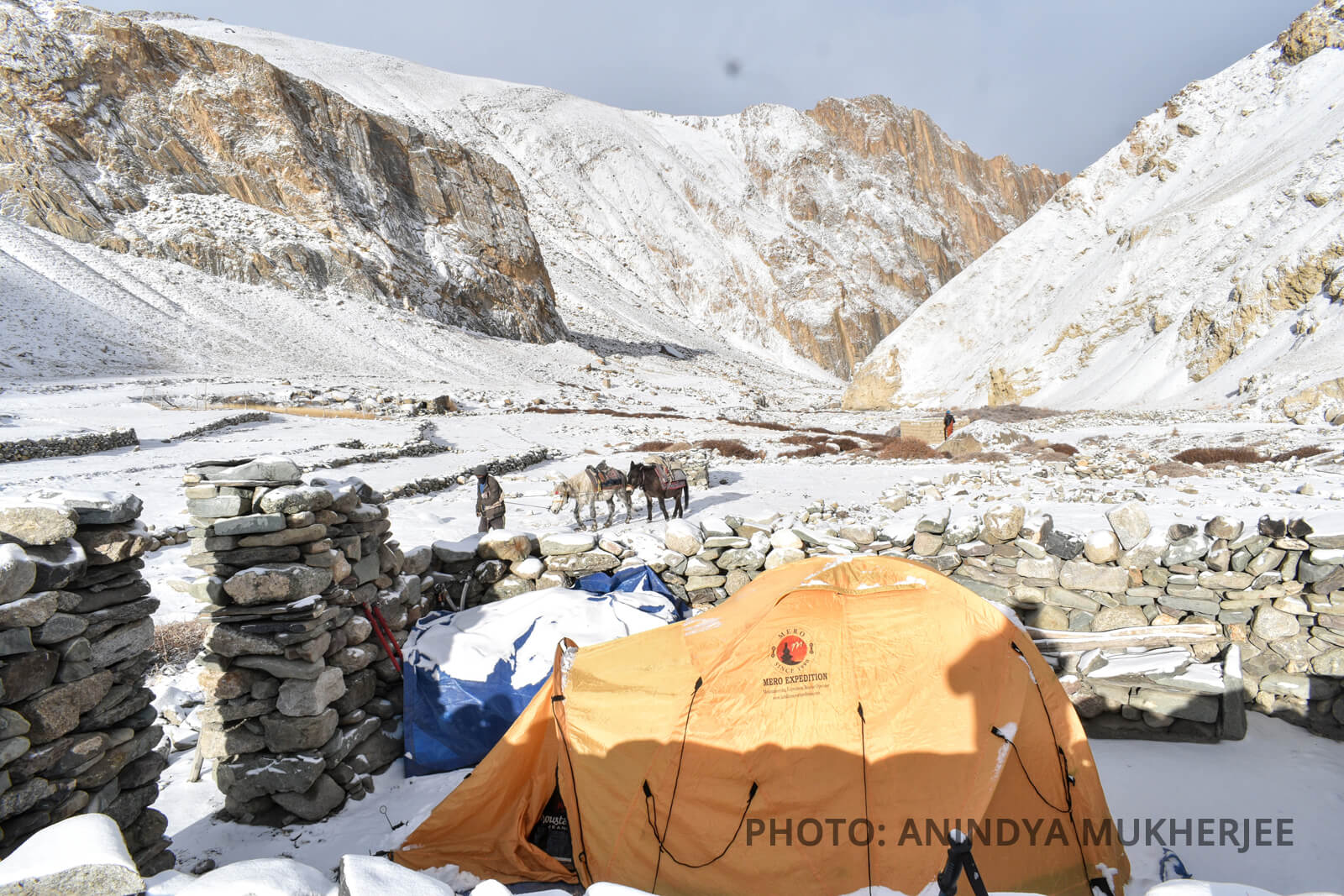
The empty quarters of Tachungtse. They decided to camp within the walls offering protection against wind. They spent 4 nights in this camp - 26,27,28th February and then 7th March.
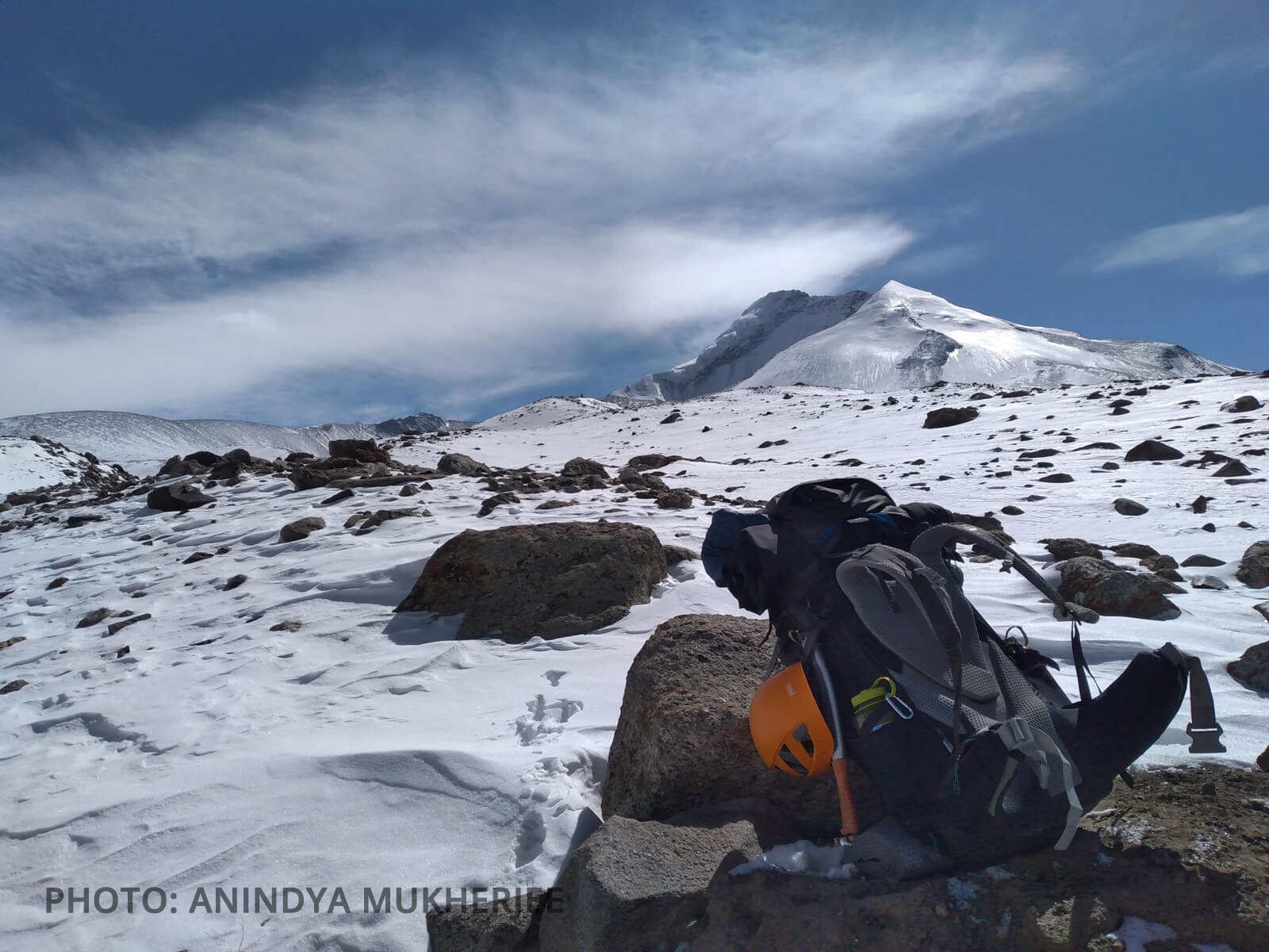
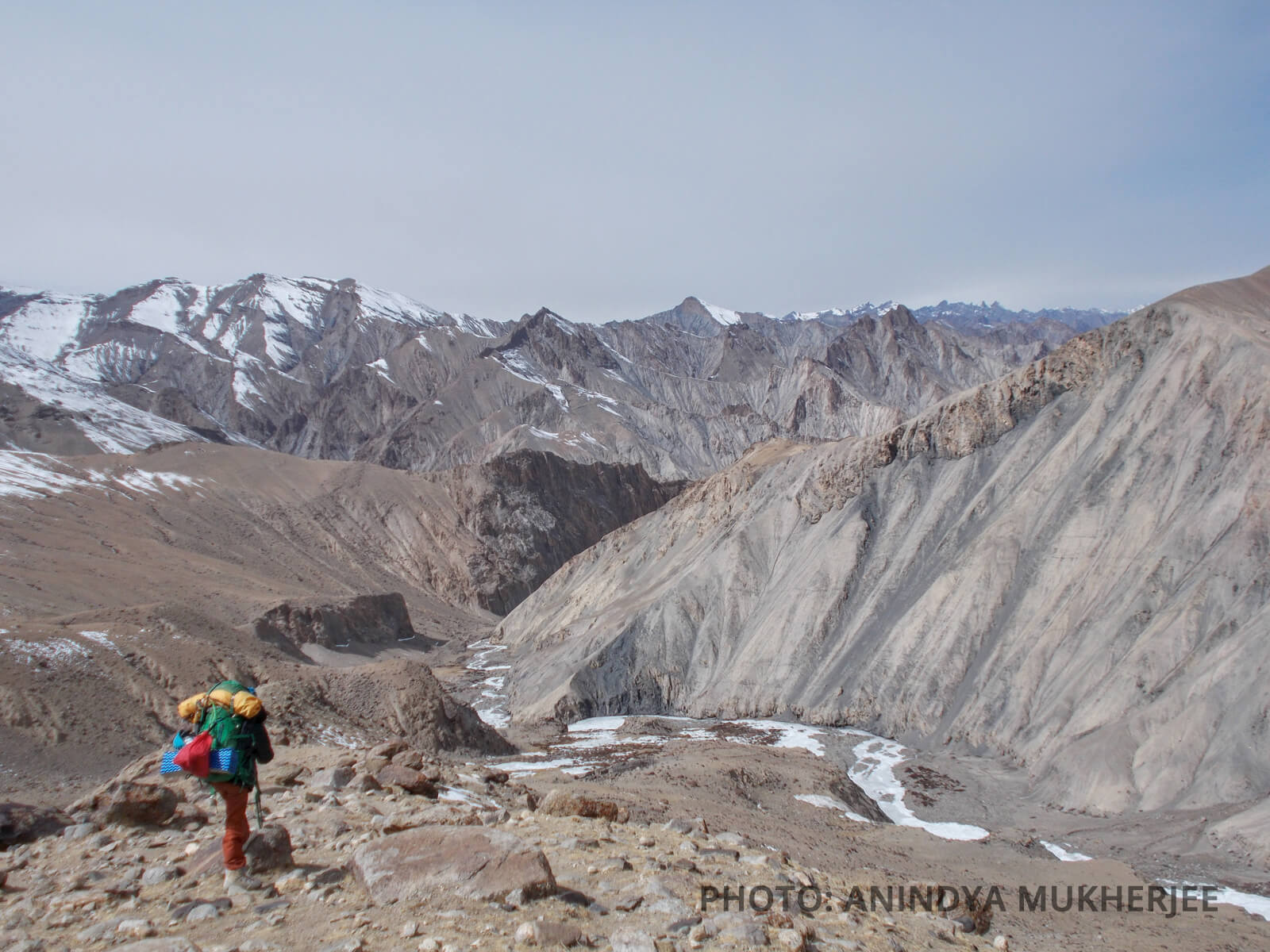
Approaching their Camp-2. The North Ridge of Reponi Malai Ri on the extreme left. Repni Malai Ri can also be seen.
.jpg)
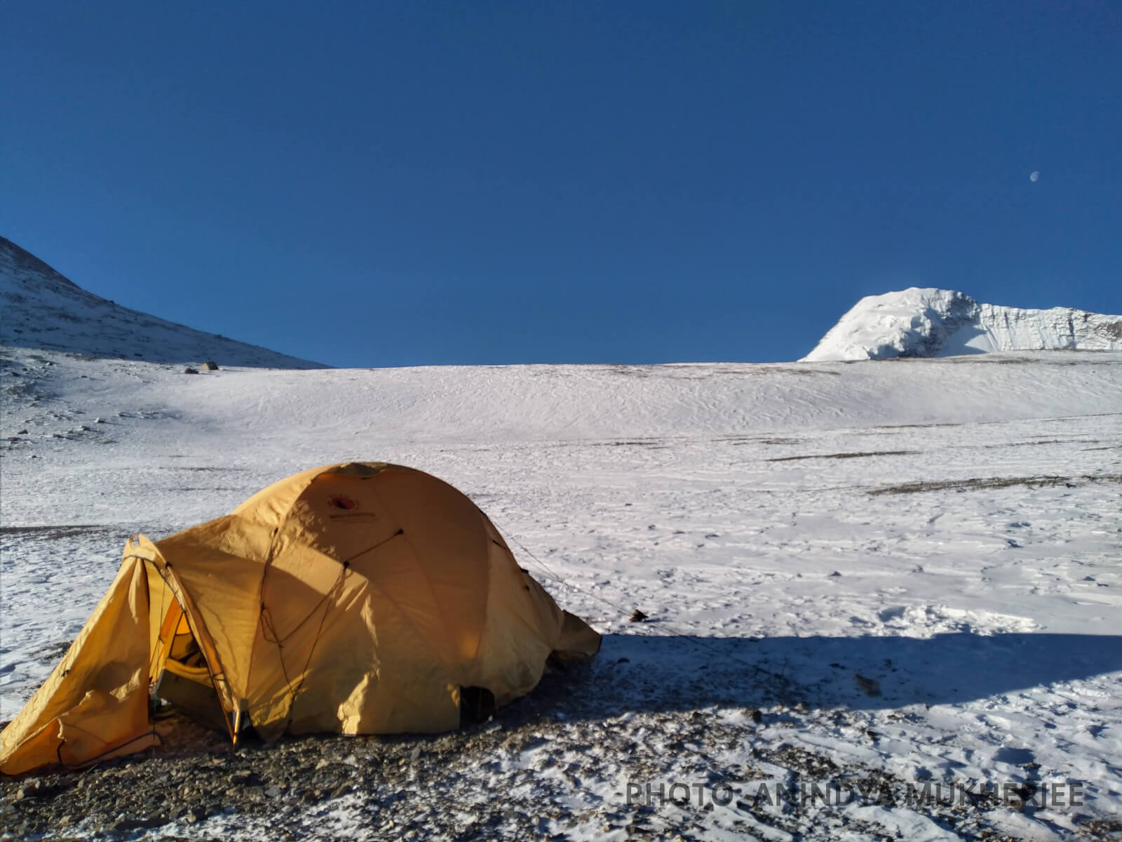
A forced camp, in effect our Camp-2. They were supposed to be making this camp on the moraine shoulder (directly above and slightly left of the tent) - on this day
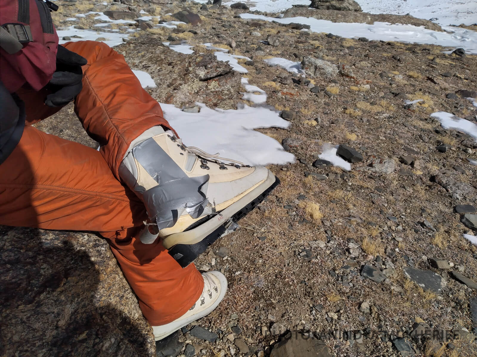
Aloke breaks the bad news
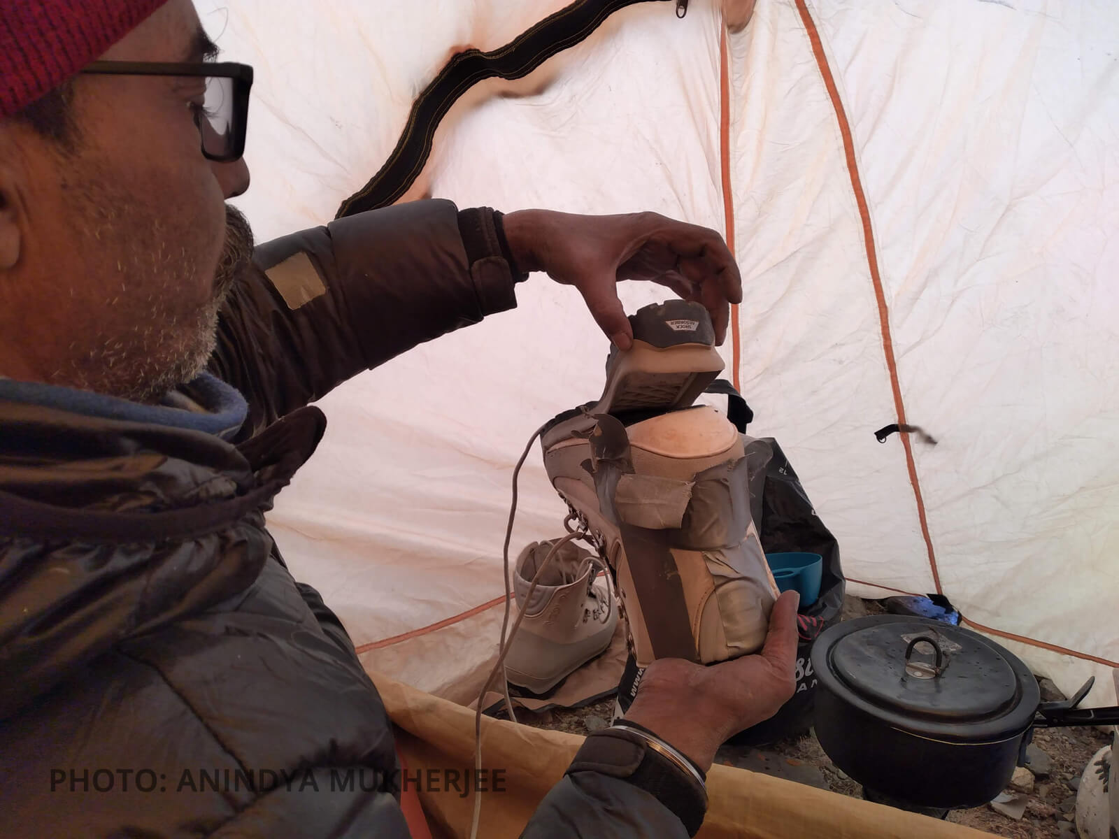
Regular duct taping of Aloke's precious boot
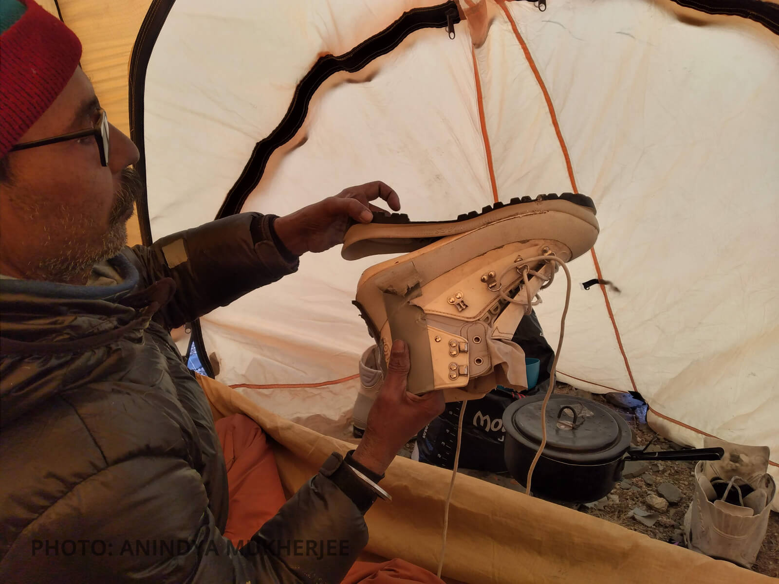
Aloke displaying the damage
The Gale
On 3rd March, the duo descended the glacier floor, plodding the knee-deep soft snow, traversed and gradually climbed up the North Ridge of Reponi Malai Ri. As soon as they were on the top of the ridge, they were greeted with high wind, blowing directly from the West. To avoid the wind, they started traversing up the ridge by staying a bit low on the East slope of the ridge. By 2pm, the gale had turned into a jetstream and hiding on the eastern slope of the ridge was not helping much. By that time the duo had reached an altitude of 5200m, and a relatively safe spot to pitch a tent. With the wind showing no signs of slowing down anytime soon, they decided not to push higher up and camped there itself. After locating a relatively level ground and two patient hours of struggle (at the expense of a snapped pole) with the wind, they were able to pitch a tent. Thus, on 3rd March, at around 4pm, at 5200m, they placed their Camp-3 (Coordinates-33°46'21.9''N, 77°34'50.0''E) on the North Ridge of Reponi Malai Ri.
Camp-3. KY I on the right and the slope on the left leads to Reponi Malai Ri
.jpg)
Camp-3, the gentle slope that forms the North Ridge of Reponi Malai Ri. The awkward bulge in their tent is the only visible sign of a snapped pole.
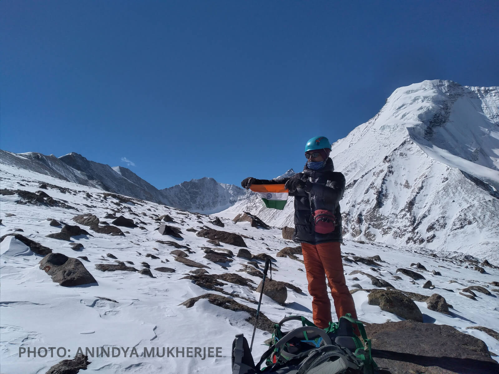
Aloke displaying the National Flag after they took the decision to turn back
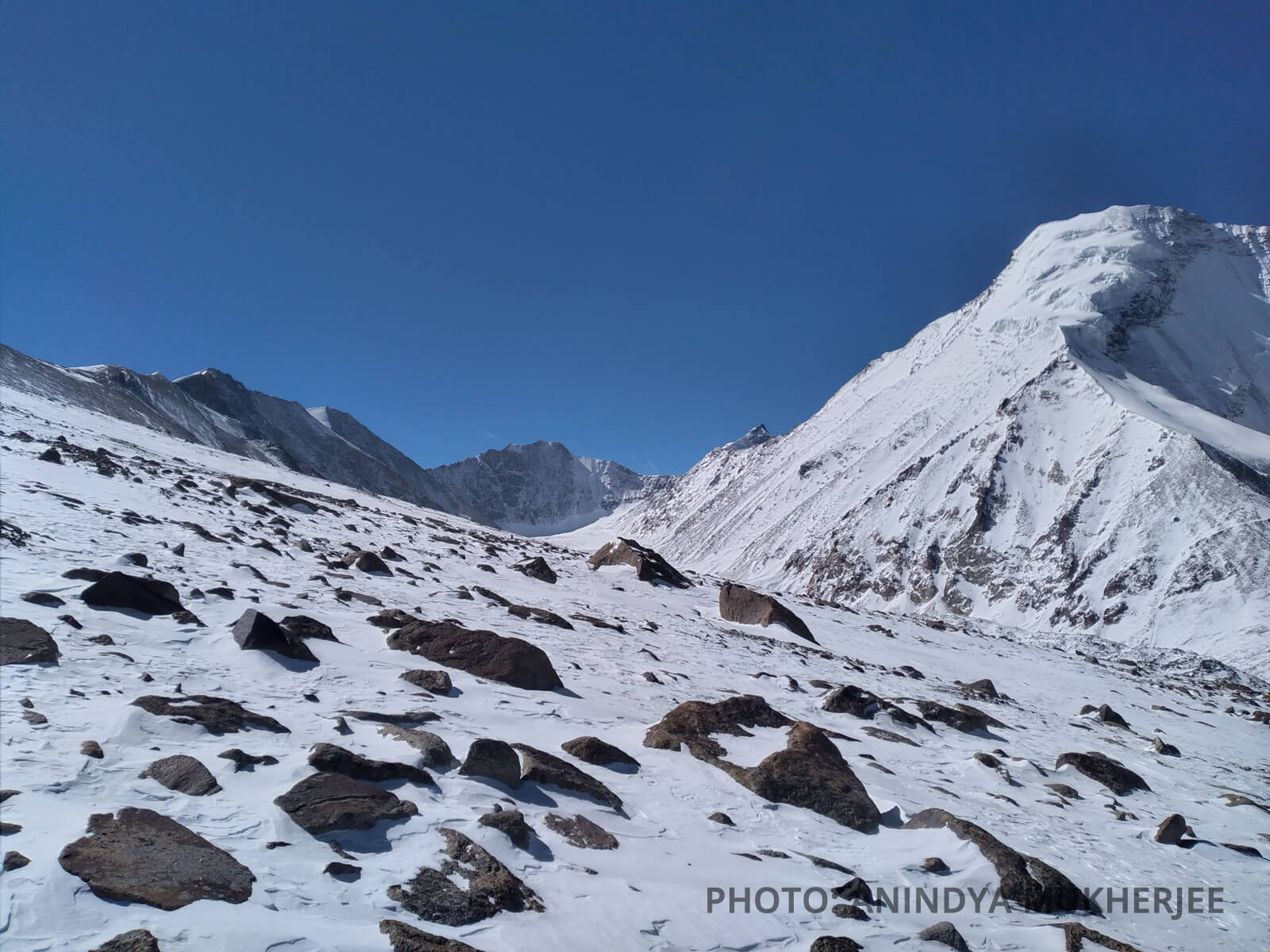
Peaks from left to right - Reponi Malai Ri (6050m), Dzo Jongo (6280m), Unnamed peak (6300m), Kang Yatse III (6310m), Kang Yatse I (6400m)
.jpg)
View from their high point of 5600m Peaks Reponi Malai Ri, Dzo Jongo, Unnamed Peak and Kang Yatse III from left to right.
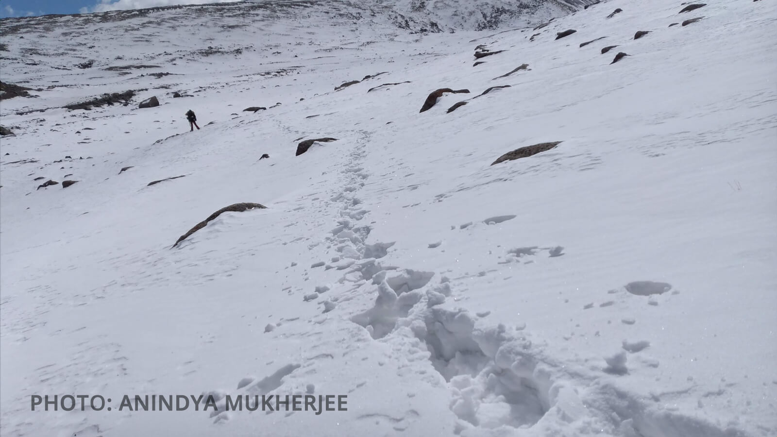
Breaking trail near the traditional Base Camp area of Kang Yatse
On 4th March morning, they pushed for the summit of Reponi Malai Ri from their Camp-3. The wind seemed to be a bit kind at this hour and by maintaining a steady pace they were able to reach an altitude of 5600m (Coordinates- 33°45'45.0''N, 77°35'07.3''E) within two hours march from their camp. It was then, Aloke realized that the duct tape had given away without his knowledge and the sole has performed a perfect vanishing act. With just one piece of a proper pair left, the duo decided to climb up no further and retraced their steps to Camp-3. On 5th March, in order to ensure safety, they took a slower, longer but less steep route back to their Camp-1. On 6th March, they were back at the relative warmth and safety of Tachungtse. On 7th March, they were back down at the village of Markha and reached Leh on the following day.
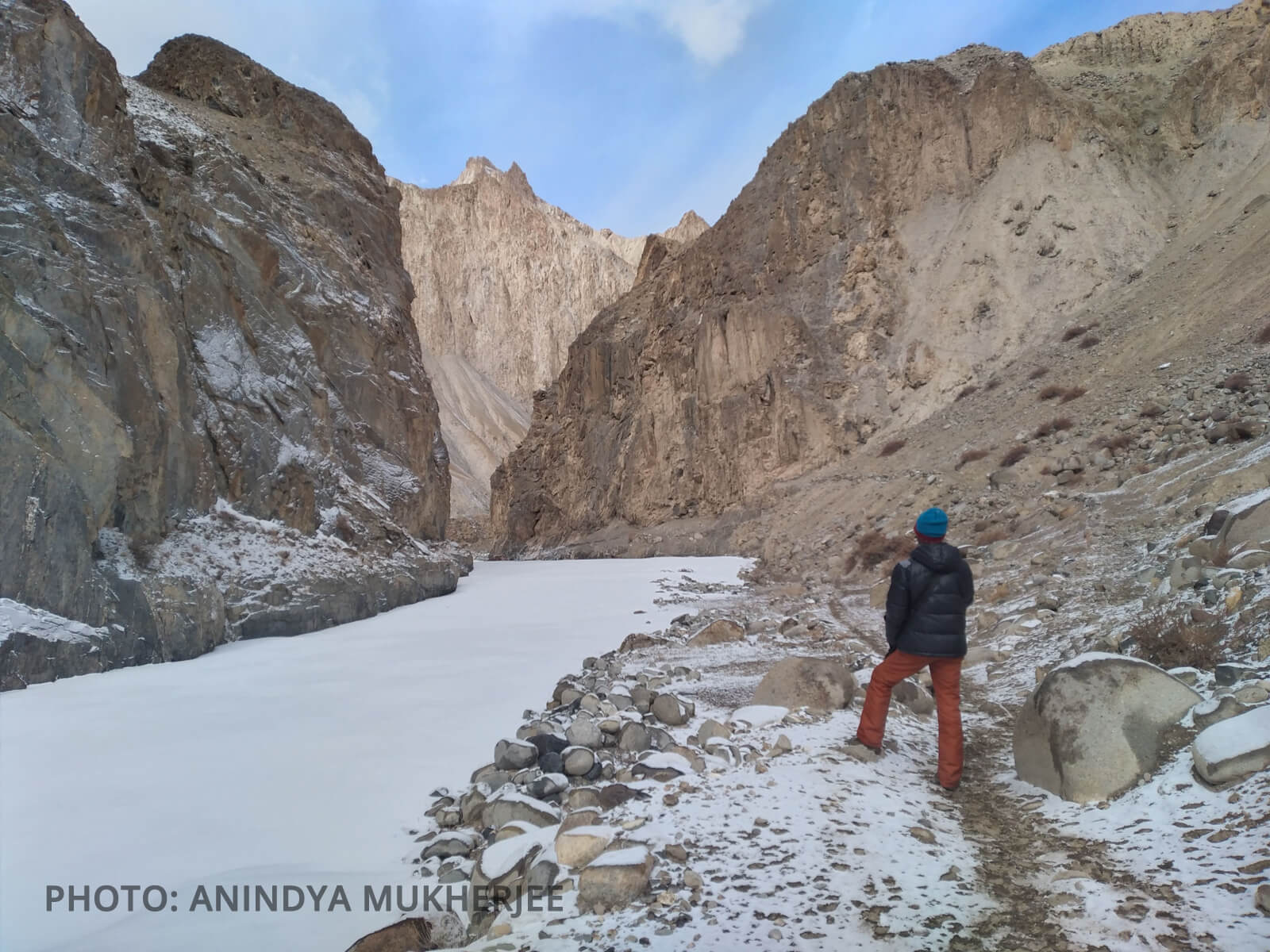
Starting from the vilage of Markha they walked many Chadars such as this before finally heading up the valley.
Kang Yatse II (left) and Kang Yatse III as seen from the roof of Tashi's house in upper Hangkar village

Collection of good quality ice from the frozen river at Tachungtse. They had to melt ice everyday for all 12 days
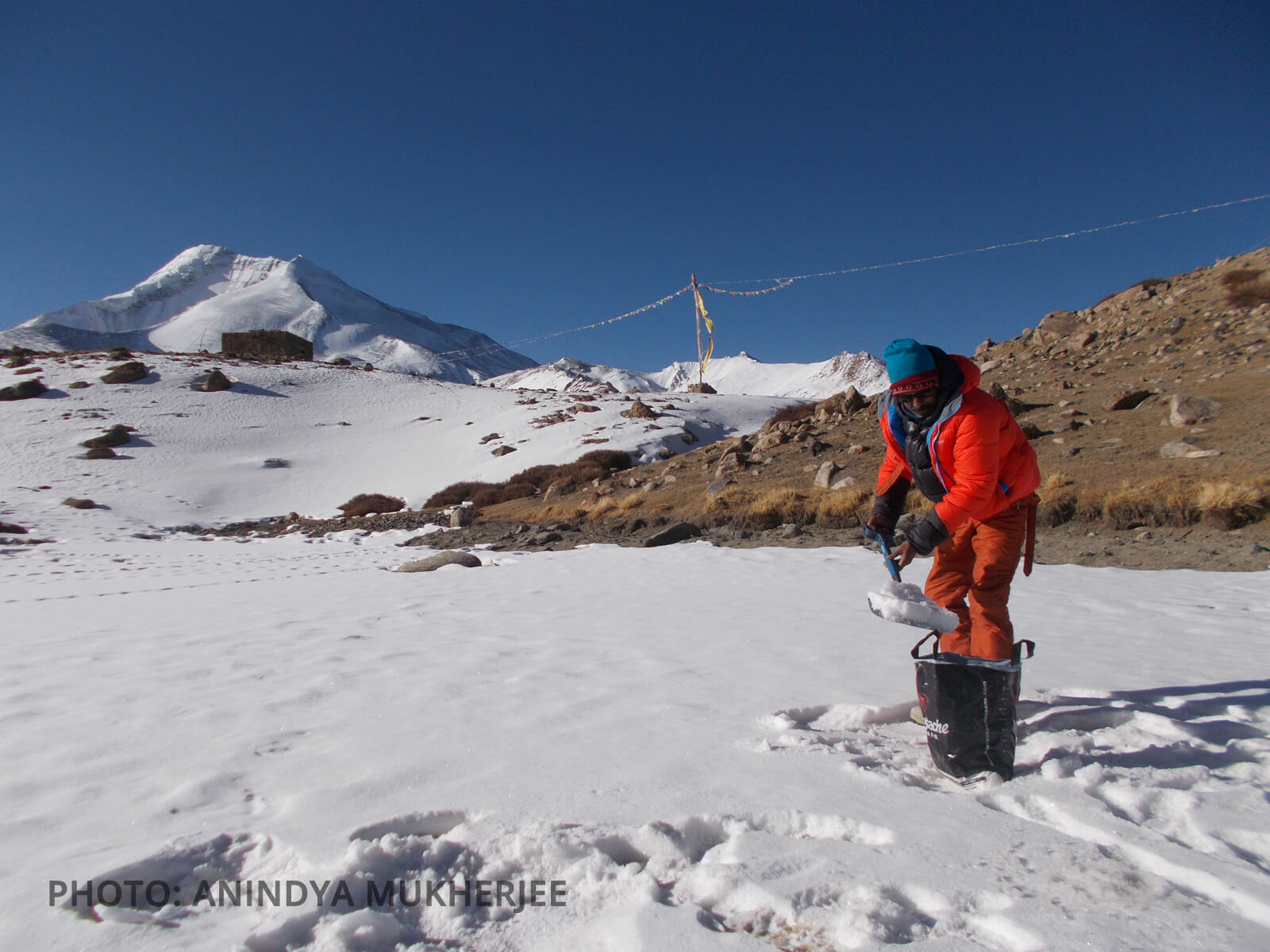
Daily chores of snow and ice collection for melting
A happy sight. Zangpo's brother Tashi arrives on the 7th March morning at Tachungtse to bring them down the valley.
Heading down to Tachungtse. Good bye Markha
Summary
Thus, what started as a puristic pursuit of a Winter adventure, culminated not on summits of mountains, but on overcoming unexpected obstacles and unavoidable situations. The two-person-team operated on their own for 12 days in the upper reaches of the Markha valley with not a single soul in sight. They made three camps, navigated and broke their own trail and reached up to 5600m. They turned back choosing safety over summit. The average temperature during their time in the mountains ranged between -15°C to - 30° Celsius. Yes, they could not stand on the summit of any peak this time, but they didn't stray from their principles either.
Gratitude
The expedition is grateful to the Indian Mountaineering Foundation for granting the necessary permission. The team members are thankful to Brig Ashok Abbey, Wing Commander Amit Chowdhury, Ka Chewang Motup, Sri Gautam Datta, Dr. Kallol Das and Dr. Rupak Bhattacharya for their kind advice and necessary guidance. We are grateful to Allied Safety Equipments Pvt.Ltd for providing us some good quality gear from Petzl and La Sportiva. The team would also like to thank Sonam Yongzor of Mero Expeditions, Tsewang Namgyal, Karn Kaushik, Rajeev Ranjan, Vijay Gupta, Avilash Bisht, Sujoy Dey, Ashish Chanda and Pabitra Chatterjee for their camaraderie and support.
The above report is prepared by Anindya Mukherjee.
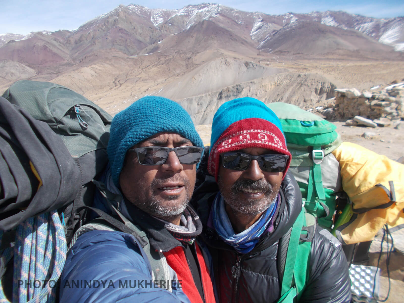
Anindya and Aloke [L to R] after wrapping up Camp-1 for the last time.
Photo Courtesy: Anindya Mukherjee


