First crossing of the Parahio Col
Debasish BardhanPhotographs: Abhijit Banik & Bhaskardeb Mukhopadhyay
Category: Trekking, Exploration, Expedition
Date of Publication: Dec 1 , 2022
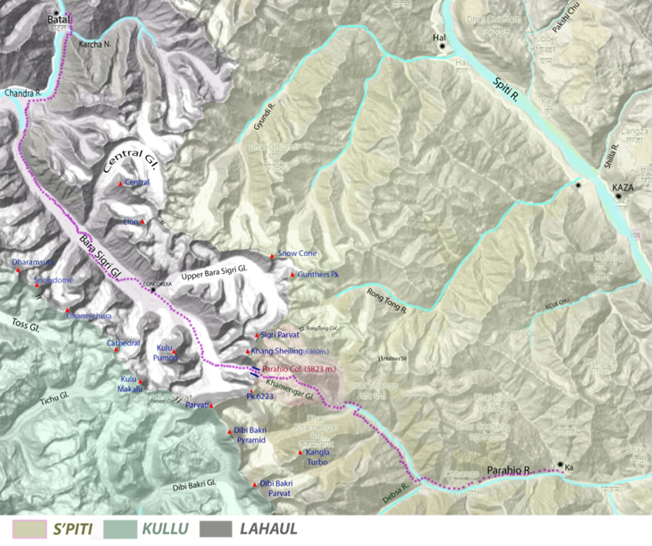
That was an afternoon to remember. We were standing on the Gyundi Col.(5767m.) and had a bird’s eye view of the panoramic majestic peaks around the Bara Shigri glacier. It was a feeling to come again, quite natural for any traveler in the Himalayas. A sensation was there in our minds given the fearful beauty of the lofty and massive rock structures and the vast ice-covered glaciers. We were simply mesmerized to see the entire beauty in a frame from Parvati Parvat to Lalana with Lion and Central peaks. The Bara Sigri glacier was never before me in the form of such a heart-touching beauty. Yes, we felt that we will have to come here again and again.
The meaning of Bara Sigri is a bit confusing. It is often pronounced as ‘Bara’ / ‘Bora’, i.e., ‘big’, because of the existence of another parallel glacier just West of it, named ‘Chota(Small) Sigri’. But it should be pronounced as ‘Baara’ to mean twelve.
The notion is that, with the growth of the West Tibetan habitat in the S’piti between the 8th Century and the 11th Century, these glaciers were marked by the pastorals. They observed twelve big peaks situated around this glacier. ‘Sig’ in the Tibetan language means ‘Mentionable’/ Main/ The One’ and ‘Ri’ means ‘Mountain’/’Peak’.
Another idea has come from the Modern Tibetan-English dictionary, i.e., ‘Tsigree’ means ‘Destroyed’ /’Broken’. Is it that the locals saw the broken form of the snout face with a lot of ice caves in the glacier and named it accordingly?
But that’s not an easy job. Observing the special character of the thick bed of the conglomerate in Middle Sivalik order, E.H. Pascoe and H. Walker, two British Geologists, realised that in 1906 when they were commissioned to survey the Bara Shigri zone of the East Punjab Himalaya. They could enter hardly three-mile inside the glacier and were able to survey the ‘Terminal Moraine Zone’.
In 1956, the Survey of India (SOI) organised a remarkable survey headed by G.N. Dutt.
After that, a lot of studies and surveys were done at the Bara Shigri glacier zone, the worth mentioning are the surveys conducted by Cambridge University and the JNU. With the development of the Remote Sensing process and other modern scientific methods, regular studies on this glacier are going on.
But the mountaineers and the alpinists started showing their interest in the early 1950s, especially after the SOI published the Map Sheet 52H. They have found ample scope to climb the virgin peaks and to observe the complex pattern of the geography of the Bara Shigri glacial system and its hinterland.
In 1941, J.O.M Roberts climbed the Dharamsura peak(6420m.), situated at the west bank of the Bara Sigri glacier, and provided a little description of the glacier. But he climbed from the Toss glacier. (AJ vol -53)
1952 – K. Snelson, V. Graff, and the team made an exploratory expedition in the Dibi Bakri, Ratiruni and Debsa glaciers - covering the southern boundaries of the Bara Sigri glacier.
1953- A.E. Gunthar first entered the Bara Sigri glacier with a climbing target, following an exploratory mode. He climbed Peak 6220 at the upper Bara Sigri glacier. He entered inside several contributory glaciers. In the Cathedral glacier, he marked the depression between the Cathedral peak and the Tiger Tooth peak as a connector between the Tichu glacier and the Bara Sigri glacier. (A.J.vol-1954) Later, this Col was named after him. In 1985, Shamsher Singh first crossed this Col.(HJ. Vol-50)
1956 – Joyce Dunseath, Eileen Gregory, Hilda Reid, and the team organized the Binger Expedition. In my understanding, that was the first serious exploratory effort in the Bara Sigri glacier area. (HJ- vol.20)
1958 - Joss P.Lynam and J.J.G Stephenson along with a big team made an exploratory expedition around the Bara Shigri glacier, Karcha glacier, and Subitha Nala/ Dongri Mo Nala near Losar.(HJ vol.- 21)
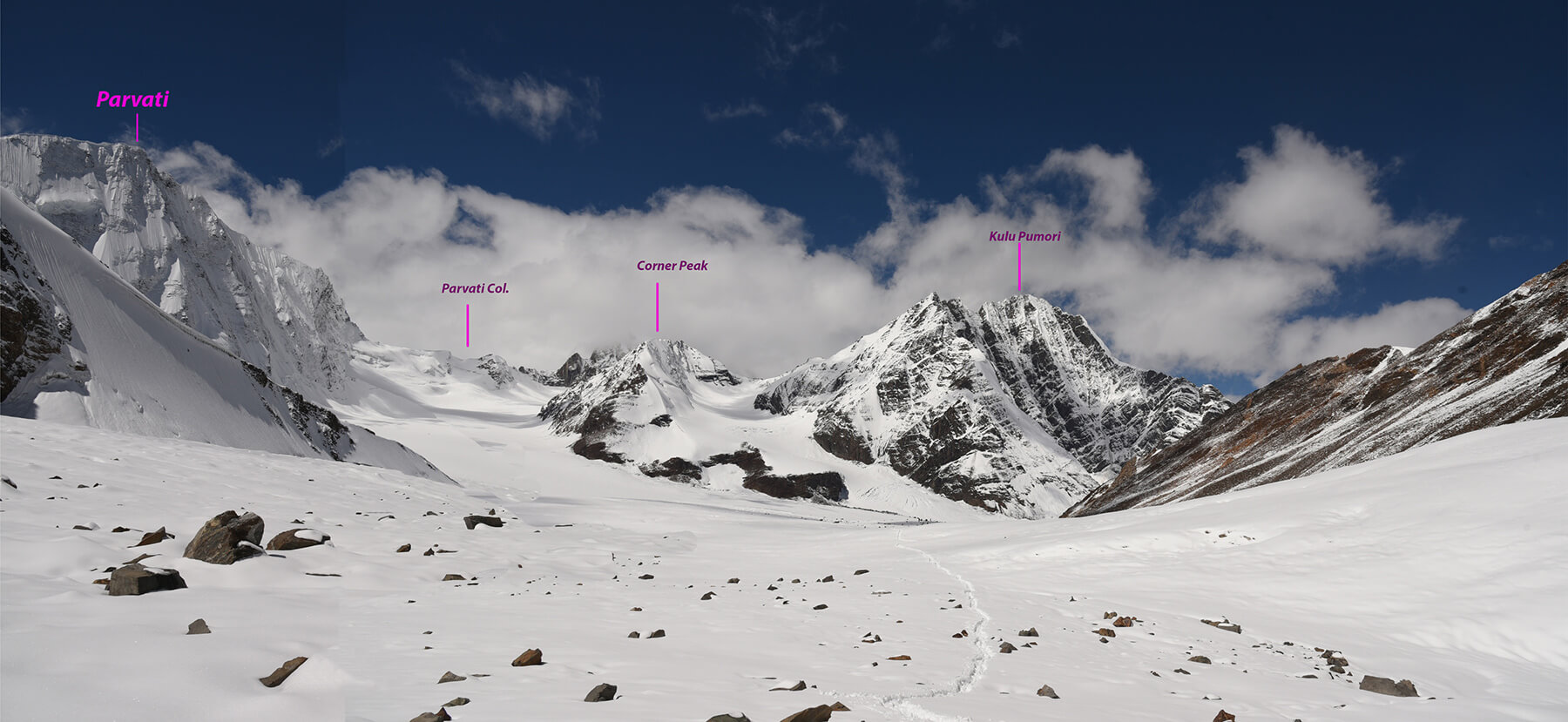
1961 – J.P.O Lynam, J.J.G Stefenson, Peter Harvey, and the team probed into the Bara Shigri glacier. That was a great expedition that has enthused me over the years. They surveyed three important wings from the Concordia Point and climbed the Shigri Parvat (6526m.)from the North side through the Upper Bara Shigri glacier for the first time. They tried to ascend Kulu Pumori also. Lynam had the plan to reach the Spiti side through the Parahio Col but could not access it due to the lack of the required Inner Line Permit.(HJ-vol.23). In that year, the Italian Alpine Club (Led by Paolo Consiglio) tried for the Parvati Parvat. They approached through the ‘DibiBakri 1st west glacier’ and Parvati Col which is lying at the west end of the Bara Sigri glacier. But nothing was written on and about their observations of the Parahio gully which is quite prominent and located just opposite of the Parvati Col.(ref. AJ -1970)
2004 – Divyesh Muni wrote about that in the report on the Khang Shiling ascent. He saw Paddy O'Leary trying for the Parahio Col from the Khamengar side but without success.(HJ-vol. 69)
1964 – Robert Pettigrew, Dr. Franz Mohling Climbed Kulu Pumori. (AJ.-vol 70)
From 2013, the IMF is organizing a Climbathon at the Bara Sigri glacier for the Alpine & Leadership training courses. In 2013, the Romanian Climbers, who participated in that program as instructors, Cosmin Andron & Mihnea Prundeanu, climbed the Khang Shiling peak from the North side. Six Indian climbers were also with them. (H.J.-vol 69). In the later years, trainees in the Climbathon climbed Corner Peak, the last peak in the glacier.
The common factor in all these efforts was that none of them went beyond Concordia Point and stressed finding out the whereabouts of the Gyundi gorge. They were much interested in scaling the unclimbed peaks in the hinterland of the Bara Shigri glacier and to establish the connector between the different river systems.
I was inquisitive to know about that part of the Bara Sigri glacier from my friends who took part in those programs. But none of them was able to show any photographs of the geographical construction of that area. So my eagerness enhanced to see a place of my own. Moreover, the article by Marino Tremonty who climbed the Parvati Parvat in 1968 and mentioned the Parahio Col and his map germinated a deep desire within me to explore that region. Also, in the last few years, I have developed an interest in finding the connectors between the different river systems and geographical variations in the Spiti. Thus, the Parahio Col was fixed as a prime target for ours.
The Expedition Story
We planned this expedition in May 2020 but due to pandemic we couldn't realise our plan. When the Himachal Pradesh govt. started allowing travel in the state by the end of August 2021, we six adventure-lover Bengalis renewed our plan to implement our idea. We prepared a plan for a traverse route connecting the Lahaul–Spiti district and the Kulu district, covering about 100 km., rather to say, to start from Batal and finish at Barseni, walk through the Bara Sigri glacier, and enter S’piti by crossing the Parahio Col. Our further wish list was to move up to the Parvati Col from East side, time permitting.
Debasish Bardhan, Abhijit Banik, Sandeep Thakurta, Bhaskardeb Mukhopadhyay, Ranodhir Roy, and Tapas Das set out for Manali in the second week of September 2021.
On 15th Sept. we reached Batal(Lahaul) and, after spending a few hours there, we moved to
Karcha Nala and moved further. Our strategy was not to have idle days but to move slowly & /or roam around. We camped at ‘Putiruni’ or ‘Chandra Flat’ by the side of the Chandra River. This ‘Chandra Flat’ has come into being, perhaps, due to the spillover of the water from the ‘natural dammed lake’. The gravel-covered ground and the water-erosion marks in the rock walls prove that. This natural dammed lake has been created by the deposition of debris from the rocky walls of the ‘Kulti stage’ near the snout. According to Hugh Whistler’s writing in 1836, the deposition of debris created a huge lake. Certainly, that lake was broken due to some structural failure before 1906.
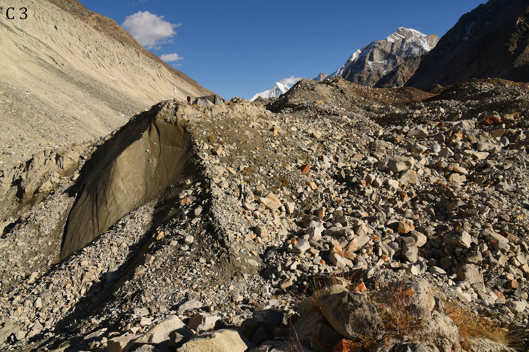
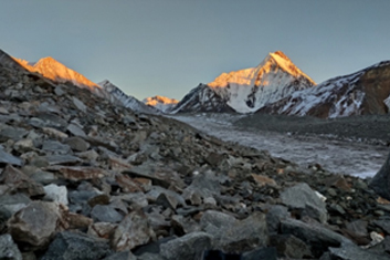
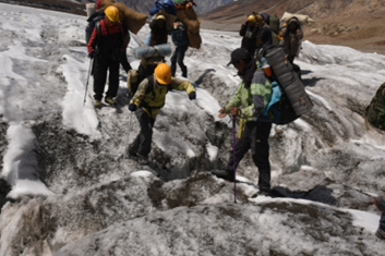
From Batal, the snout point of the Bara Shigri glacier (3984m.) is 12 km. The next day, we crossed the snout point. We found many ponds there filled with bright sky blue algae. The presence of ‘Cyanophyta’ is the cause of the sky-colored water. We moved through the terminal debris humps to move over the glacier by the East side of the snout. Every mountaineer has written about the treacherous course in the terminal moraine zone. Big-sized loose boulders have covered the terrain. In this autumn season, snow is scarce and the boulders are unstable for making steps. Our movement became tougher because of the numerous big glacial humps of hard ice covered with boulders. It was also a scree zone and was full of broken ice caves below the humps, making our progress slow. It is a rigorous task. At the end of the day, we pitched our tents in a dried glacial pond.
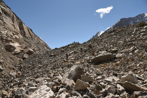
Big Glacial Humps of Bara Sigri Gl.
Water flows beneath Glacial humps.
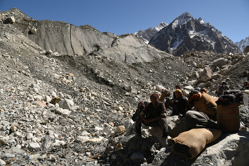
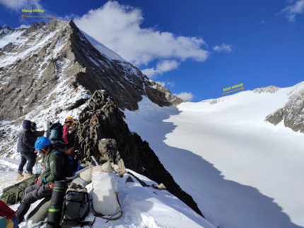
Supporting Friends seated below of Icy Glacier
Our Third camp over Glacial humps
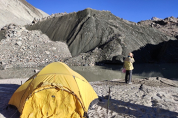
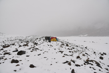
Our Second camp by glacial pond
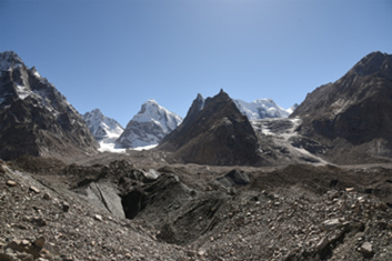
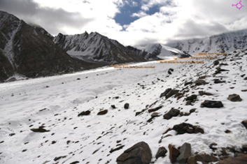
West Bank of Bara Sigri, Snow Dome peak & Tosigiri Col visible
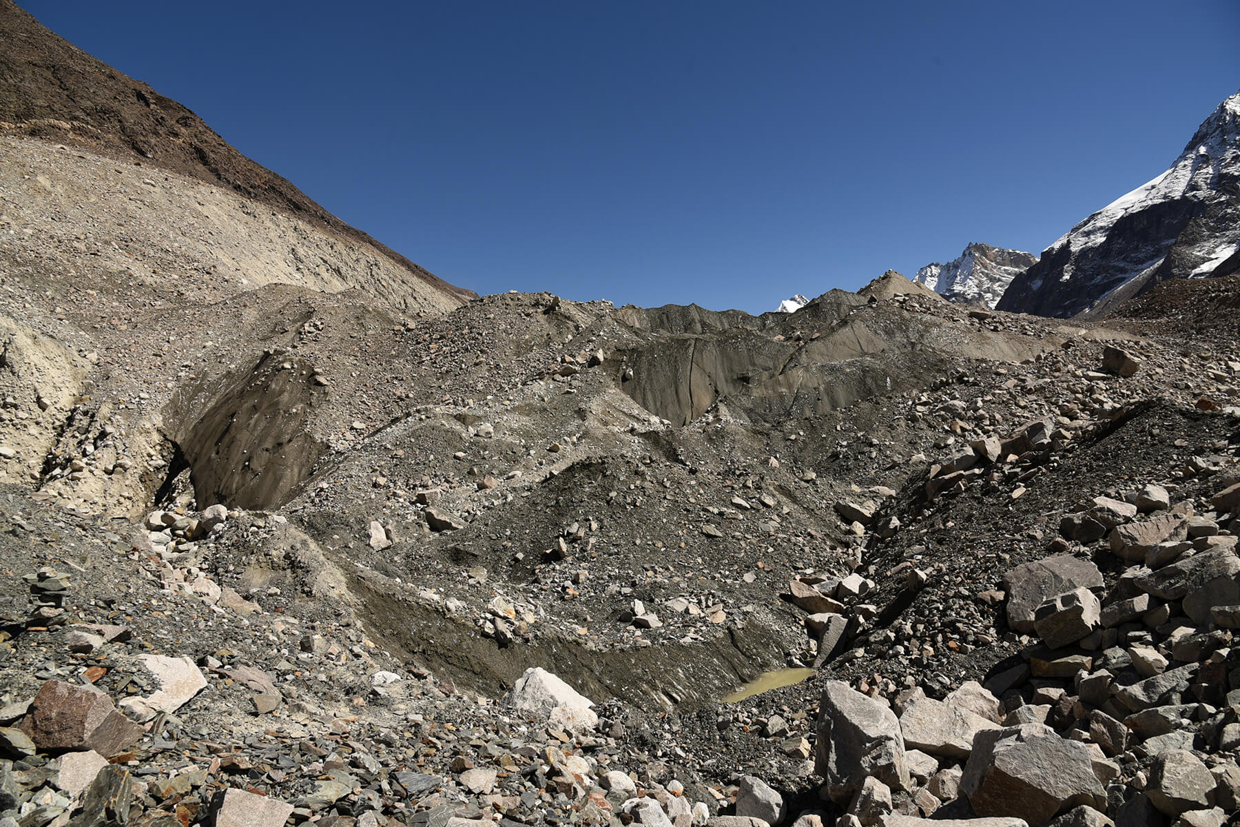
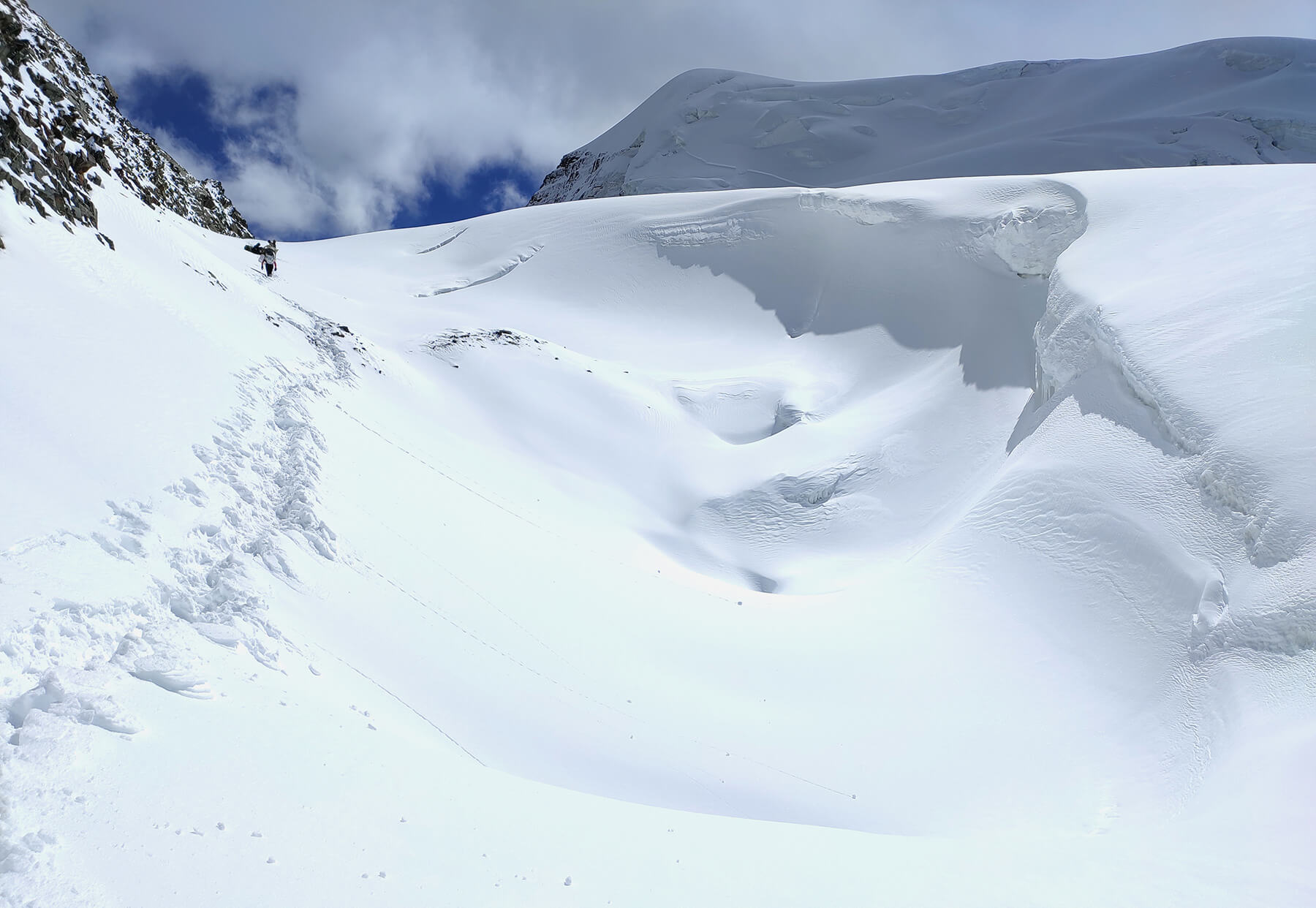
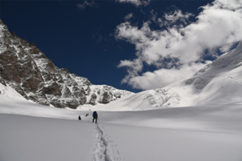
In the next three days, we walked over the Bara Shigri glacier in the same manner. The glacial composition near the Central glacier confluence is an intricate one. The terminal moraine zone of the Central glacier is coming down from 4970m.(approx.) and hitting the Bara Sigri glacier at 4540m.(approx.). So, the stream flows from the Central glacier. And, the debris coming down by the steep gradient seems to put pressure on the Bara Sigri glacier to the West. We had to divert our movement to the West. On the fifth day, I observed that we were following the West side of the medial moraine, dispersing from the East, to make our move easier.
Following the icy glacial course, we made our fifth camp at the Concordia (4820m), covering 12 +20 = 32 km. in five days, one day more than my estimation. A.E . Gunther named the place Concordia in 1953. It is easy to understand the name Concordia because some glaciers confluence here; from the East, the Upper Bara Shigri glacier, and from the West, the Cathedral glacier and Lal Quila Gl. The next day, we reached below the Kulu Pumori peak, moving over the scattered open crevasses all over. Here the Bara Shigri glacier turns to the West. Though we had to cross more than ten crevasses but we're lucky enough because all were open and we got small fragile bridges every time.
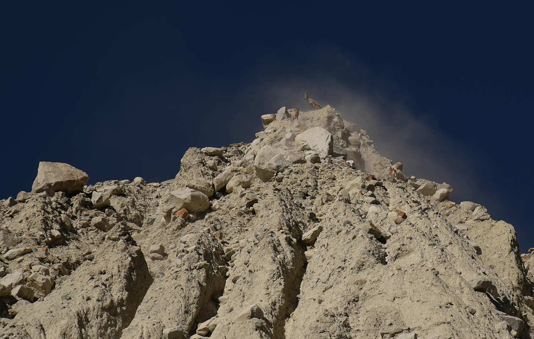
Mountain Sheep ( Bharal ) atop of Central Glacier
Stream coming down to Bara Shigri from Central Glacier
Peak 6223 (at middle) & Kulu Pumori from Concordia
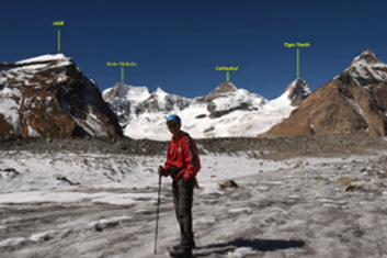
Bhaskardeb at Concordia, Cathedral Gl. In backdrop
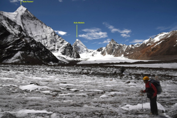
Sandeep in the confluence of Lal Quila Glacier South to Cathedral Glacier
'Jump' ! - common practice of crossing small crevasses
The internet weather forecast site reported that on the 20th. Sept. huge snowfall may take place which may continue for three/four days. Following the prediction, snowfall started on the 19th night and continued for the next whole day. It was almost 45cm. snowfall as
predicted. The continuous sound of avalanches from the walls of the ‘Parvati’ kept us awake.
Sixth Camp below Kulu Pumori after snow fall 20th morning
Four contributing glacier from east beyond Concordia
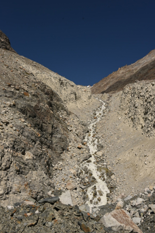
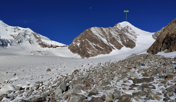
From here to the East, three glaciers feed the Bara Shigri glacier. The Northern one originated from the walled block encircled by the three peaks of height above 6200m. The Middle glacier comes from the Northern walls of the Shigri Parvat and the Khang Shiling peaks. In 2013, the Romanian climber, Cosmin Andron, attempted the Shigri Parvat and successfully scaled the Khang Shiling. The third one originated from Peak 6223. Except for these three, there is a blind narrow gully at the Southern end. There is a very confusing location of the third glacier which finishes at the NW rocky wall of Peak 6223. So, based on the map study, I assumed that the third glacier would be our route to access the Parahio Col.
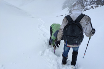
The next day snowfall stopped and hurriedly we move to the Parahio gully*. But, after an hour, heavy snowfall started again when we could cross half of the Bara Shigri glacier.
(*) Though the word -‘Parahio’ concerns Spiti , because Parahio is an important river of Spiti which met with the Pin River near Sangam. Early surveyors & mountaineers mentioned the whole area as Parahio Valley before ‘Khamengar’ is demarcated as a separate glacier. Now Khamengar Nala & Debsa Nala meets at Thango and is named Parahio River onwards; here I want to mean the Southernmost contributing glacier of Bara Sigri from the east. Since Parahio Col is located at the end of the glacier –we used to ask by that name.
Returning from there was not wise. So we moved forward. From our last camp, the Bara Shigri glacier’s width is about 1.8kms.and the Parahio gully’s length is about 4.85 km. I had an idea that there is a possibility of cwm in the middle of the glacier. So, we planned to make our camp over there. Our trail followed a mixed terrain of rock and ice, covered with the snow deposition of the last two days. There were many crevasses en route and an icefall on our right. We camped at the small cwm at the height of 5520m. A very small pond was the only source of water but it was frozen.
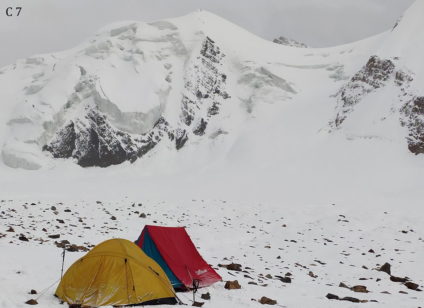
Seventh Camp at 5220m below the Col.
Access to the Col. by Icefall zone
Measuring amount of snowfall
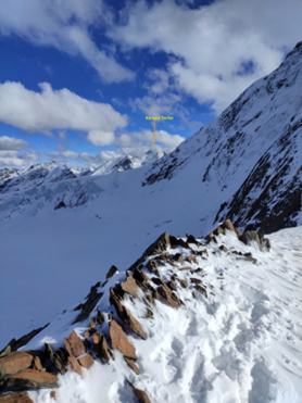
Trail to Col. Ridge of Khang Shilling(left) & Pk.6223 (right)
Panoramic view from Camp 7
On 23rd Sept., heavy snowfall happened throughout the day. Abhijit Banik, Lakpa, and Milan (supporting friend) made a recce to the Col. They moved to the Col and informed by walkie-talkie after two-and-half hours that they reached the top and kept some equipment there. In the evening snowfall stopped and the sky was full of stars. We decided that we would move for crossing the Col. if the next morning was clear. Abhijit had a wish to recce up to the Parvati Col for which he needed a small team and three extra days to spare. But we decided to use the better weather for our prime target.
On 24th Sept. the morning was misty but cleared after some time. The trail was moderate as one finds in glacial terrain. On our right side, the formation of an icefall was visible. The glacier is narrow and steep at the last stage but the packed snow made our trail comparatively easy. The last member reached the Parahio Col at 13 hrs.
The Parahio Col is the lowest depression point in the ridge between the Khang Shiling (6325 m.)peak and the Peak 6223m. which is over the East ridge of the Parvati Parvati (6636m.)
( Parahio Col .— Height 5823m.; Co-Ordinates –- 32* 06’ 46.34” N // 77* 46’ 31.79” E )
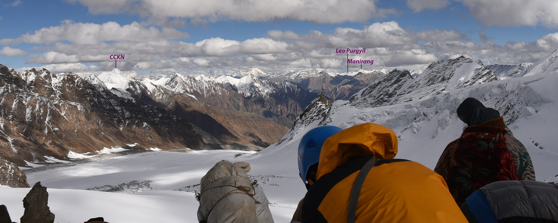
On the Col, the place is narrow and too windy. In the N-E corner, the Sigri Parvat was visible, in the S-E, Reo Purgyil(6816m.)peak was remotely seen and to the little South of it, the Peak Manirang (6593m.) was visible. In front of us, we could see Peak 6150 (named Peak Guru Ganesh by a team that climbed it in July 2021) & Peak 6085 over the Khamengar-RongTong watershed wall. Behind it, the Peak CCKN(6303m.) was seen in the remote East. The Kangla Tarbo(6315m.) peak is in the southern corner. Reaching Col. Abhijit, Lakpa and I became busy fixing the rope for descending. Few rocks were peeping over the ice bed but were too fragile to anchor. So two snow-stakes were used for anchoring. I had an idea from the map that the wall portion from the Col. would be hardly fifty meters to descend but, while fixing the rope, I realized that it would be about to hundred meters. Two ropes were fixed to the bottom. The rocks were in the projected form. So the bottom of the wall could not be seen from the top. The First 10-12 meters of the wall were about 70 degrees and the rest portion was about 80 degrees in terms of the gradient.
Members atop Parahio Col. (5823m.) .Ridge of Khang Shiling & Sigri
From Parahio Col. - Southern side - Kangla Tarbo
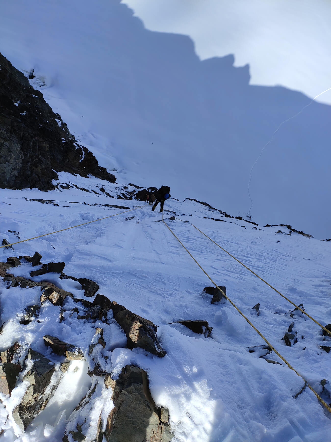
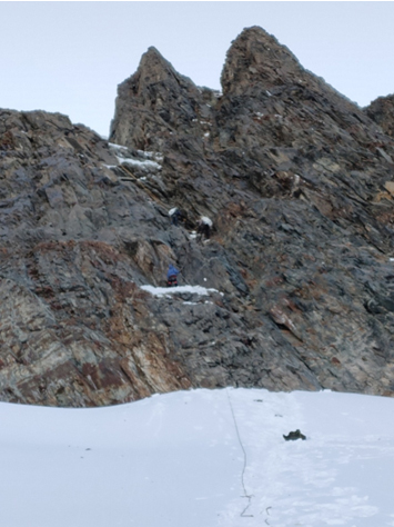
First pitch descending from Parahio Col.
Last pitch descending. Abhijit helping porters.
Panoramic view of the East side from the Col. Khamegar glacier at below.
In between, some portions were projected. Rocks are black slate. So driving a piton in between the wall to make another anchor en route was not worth it. Tapas first rappelled down and made a fall line of rope. But descending of eleven porters by belay was a time-taking event. Sandeep & Bhaskar became very nervous. So, they also descended taking belay. Abhijit & Lakpa helped them a lot.
After reaching the Khamengar glacier, Sandeep was overjoyed and everyone was happy too for crossing the Parahio Col for the first time. It was late afternoon and we saw that the porters already pitched the kitchen tent on the Khamengar glacial bed. Our descending route was the East slope from the Khang Shiling peak--about 40-45 degrees and covered with soft snow. The weather was clear and the cold was too much. We moved toward the glacial bed confidently. At the last, Abhijit, Sandeep, Bhaskar, Lakpa, Vinod, and Naresh descended in a group.
The Fateful Night
Everyone was exhausted but the fatigue level of Bhaskar and Sandeep was high after three hours of walking down. They were moving very slowly. So Lakpa helped Sandeep and Vinod helped Bhaskar to take steps. At around 10.30 p.m., Sandeep developed delirium. Lakpa took him on his shoulders and came down faster and Bhaskar could not stand on his own. After half an hour Sandeep suddenly threw away his gloves and intended to open his jacket. Abhijit sensed that something was going wrong due to over-exhaustion & exposure. He gave oxygen to Bhaskar. We were not practically experienced to handle the case of Hypothermia. Quickly, he put them inside their sleeping bags and placed them over the carry mat. Meanwhile, I sent two porters to help them. Lakpa brought a tent and put them inside as soon as possible.
They came back at 1 a.m. in the mid-night and told that Sandeep had already expired and, Bhaskar also might not able to survive, as Lakpa couldn’t feel his pulse beats.
Ranodhir Roy and Himal Rai(supporting friend) got frostbite on their feet.
Camp side at Khamengar Glacier and entire trail of descending.
In this situation, we postponed the second part of our program.
The next morning, I sent Abhijit & Jivan to Mikim to inform the District Administration about the mishap & to get help to rescue the dead bodies. They moved promptly. Being informed, the ADC/KAZA, Mr.Mohon Dutt, took prompt action to recover and bring down the dead bodies to Kaza with help of the ITBP and the Dogra Scout. A post-mortem was done at Kaza, revealing the cause of death as Pulmonary Oedema and Hypothermia. Mr.Dutt took care of the entire team also in a benevolent manner. We’re thankful to H.P. Govt.
On 3rd October, We brought back the dead bodies of our friends to Kolkata with the help of the Govt. of West Bengal.
Photo: Abhijit Banik & Bhaskardeb Mukhopadhyay

Related Articles


Place your ad here. Call +919163231788 or Contact Us


